Back working in Sonora in June, July, August, September, October, November and December of 2014, I started exploring the California Historial Landmarks in Calaveras County. Sites that I visited included:
Valley Springs [#251],
San Andreas [#252],
I.O.O.F. Hall [#256],
Fourth Crossing #258,
Congregational Church [#261],
Stone Corral [#263],
Chili Gulch [#265],
Jenny Lind [#266];
Mokelumne Hill [#269];
Pioneer Cemetery [#271],
Douglas Flat [#272];
Carson Hill [#274],
Robinson's Ferry [#276],
Angels Camp [#287],
Altaville [#288],
Vallecito Bell Monument [#370];
Old Mining Camp of Brownsville [#465],
Red Brick Grammar School [#499],
Angels Hotel [#734] and
Birthplace of Archie Stevenot [#769].
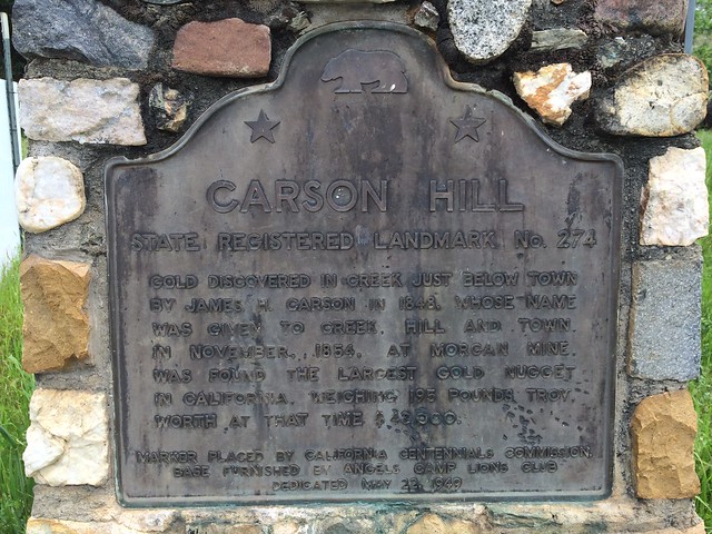
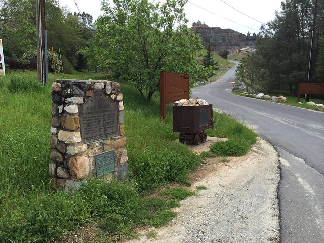
Carson Hill
California State Historical Landmark #274
See this location on Yahoo Maps in Flickr
See this location on Google Maps
This landmark is located 3.7 miles south of Angels Camp on Highway 49, California in Calaveras County.
There are 40 other California State Historical Landmarks in Calaveras County. The GPS coordinates for this location are N 38° 01.659 W 120° 30.400.
You can
log your visit to this landmark at waymark.com.
Gold was discovered in the creek just below here in 1848 by James H. Carson, whose name was given to the creek, hill, and town. In November 1854 the largest gold nugget in California, weighing 195 pounds troy, was found. It was worth $43,000 at that time.
No comments:
Post a Comment