Showing posts with label National Register of Historic Places. Show all posts

Wednesday, May 15, 2024

Jessie Street Substation

Sharon and I toured the Jewish Comtemporary Museum on Day 2 of our Mother's Day Weekend trip to San Francisco. The museum is housed in the Jessie Street Substation.

Jessie Street Substation
National Register of Historic Places #1974000555

See this location on Yahoo Maps in Flickr
See this location on Google Maps

This church is located at 736 Mission Street, San Francisco, California. The GPS coordinates for this location are 37° 47' 09.5" N 122° 24' 12.4" W.

You can log your visit to this landmark at waymark.com.

Jessie Street Substation
This Classical Revival building was originally constructed in 1881 but was remodeled twice by Willis Polk between 1905 and 1909 after being damaged by the 1906 earthquake and two fires.

It served as an energy utilities substation until 1924.

Jessie Street Substation is also San Francisco Landmark 87.

Monday, August 08, 2022

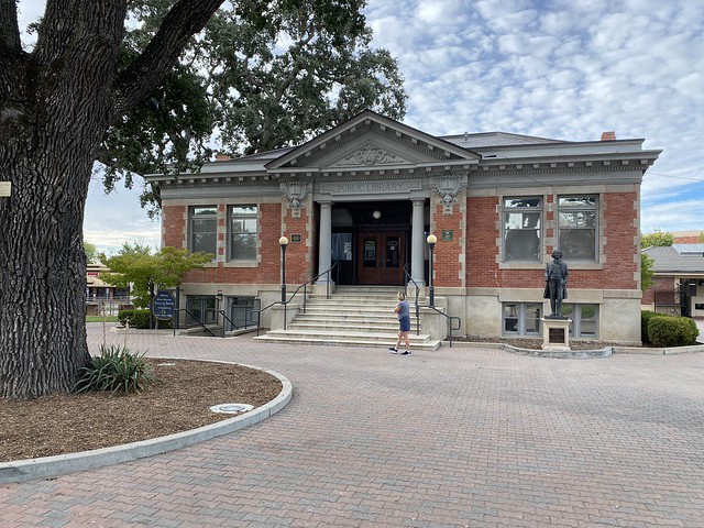
Paso Robles Carnegie Library

Sharon and I walked by this historic place while walking around the downtown last Friday.

Paso Robles Carnegie Library
National Register of Historic Places #1997001635

See this location on Yahoo Maps in Flickr
See this location on Google Maps

This church is located at 800 12th Street, Paso Robles, California. The GPS coordinates for this location are 35° 37' 34.4" N 120° 41' 24.3" W.

You can log your visit to this landmark at waymark.com.

Paso Robles Carnegie Library
The Paso Robles Carnegie Library is a Carnegie library located in Paso Robles City Park in Paso Robles, California. The library was built from 1907 to 1908 through a $10,000 grant from the Carnegie Foundation. Architect William H. Weeks, who designed several other buildings in the city, designed the library in the Classical Revival style. The projecting front entrance of the building has an ornamented pediment supported by two columns and two wide brick pilasters. The building has a decorative cornice, and an ornamental frieze is located beneath the pediment and cornice at the entrance. The Works Progress Administration expanded the back of the library in 1939. The library operated until 1995, when it was replaced by a new building and purchased by the city's historical society.

Paso Robles Carnegie Library

Wednesday, May 26, 2021

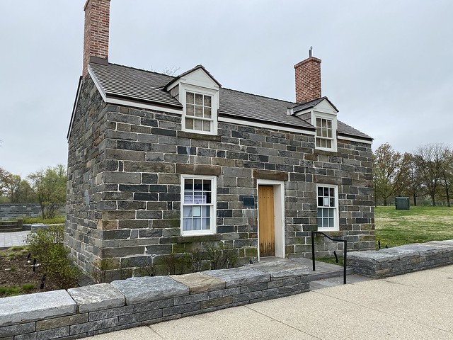
Lockkeeper's House, C & O Extension

We passed this building multiple times during our trip to DC in April.

Lockkeeper's House
C & O Extension

National Register of Historic Places #1973000218

See this location on Yahoo Maps in Flickr
See this location on Google Maps

This church is located at southwest corner of 17th Street and Constitution Avenue, NW, Washington DC. The GPS coordinates for this location are 38° 53' 31.1" N 77° 02' 23.3" W.

You can log your visit to this landmark at waymark.com.

Lockkeeper's House
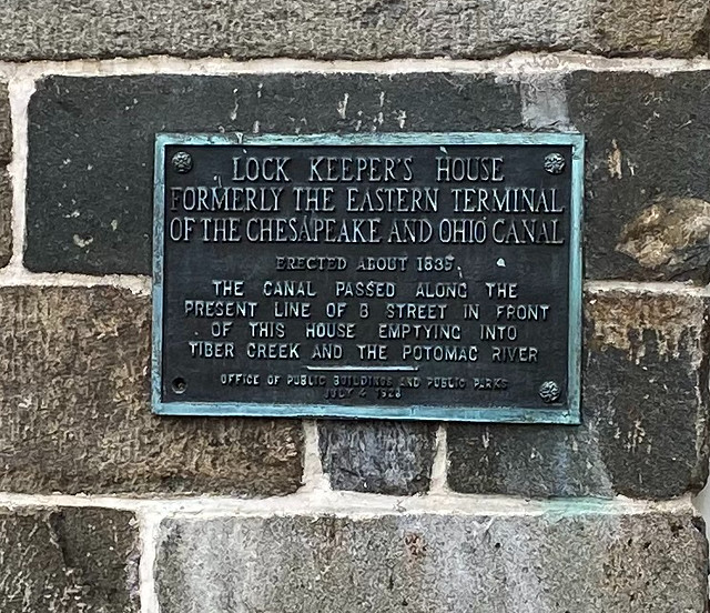
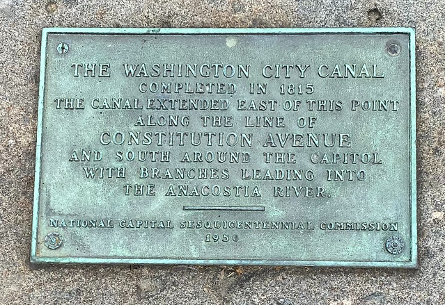
The Lockkeeper's House is the only remnant of the C & O Canal Extension. The building was constructed as the house for the Lockkeeper of the Canal, who collected the tolls and kept records of commerce on the canal. The C & O Extension was built between 1832 and 1833 to connect the Washington City Canal with the C & O Canal. The Washington City Canal was first proposed by Pierre L'Enfant in his 1791 plan for the Capital and was opened in 1815. It served as the major thoroughfare until railroads became the dominant form of transportation in the 19th century. Furthermore, the local, Washington City Canal, was beset by problems of poor maintenance.

After the Civil War there were numerous proposals to revitalize the Washington City Canal, but in the 1870s the long process of filling the canal began. During the development of Potomac Park in the early 1900's, the Lockkeeper's House was given to the United States and functioned for a while as the Park Police headquarters. By 1940 Federal Office buildings began to appear along Constitution Avenue near the Lockkeeper's House. That year, the first floor of the building was converted to use as a public comfort station. Presently the building is used for park maintenance storage.

Lockkeeper's House Untitled

Friday, November 22, 2019

Woodrow Wilson Birthplace

We visited the Woodrow Wilson Museum and Presidential Library during our East Coast trip this summer.

Woodrow Wilson Birthplace
Also known as The Manse

National Register of Historic Places #1966000926

See this location on Yahoo Maps in Flickr
See this location on Google Maps

This church is located at 18 N. Coalter Street, Staunton, Virginia. The GPS coordinates for this location are N 38° 09.039 W 079° 04.119.

You can log your visit to this landmark at waymark.com.

Woodrow Wilson birthplace, The Manse

The house was built in 1846 and was the home of the minister of Staunton’s First Presbyterian Church. The house became the home of Dr. and Mrs. Joseph Wilson in 1855 and on December 28, 1856, Thomas Woodrow Wilson was born in this here. The Wilson Family left Staunton when the future president was still and infant and move to Augusta, George where they lived until Woodrow was about 14-years old. After the Wilson’s moved from this house is remained The Manse for the Presbyterian Minister until the late 1920’s. After President Wilson died, his second wife, Edith, returned to Staunton with plans preserve the house as a presidential memorial. The house was acquired by the Woodrow Wilson Birthplace Foundation in 1938 and was dedicated as a museum by President Franklin D. Roosevelt in 1941.

Tuesday, June 26, 2018

Carnegie Hall

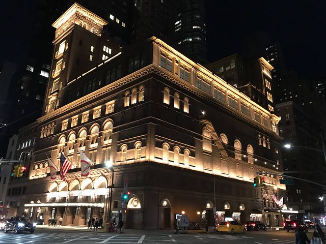
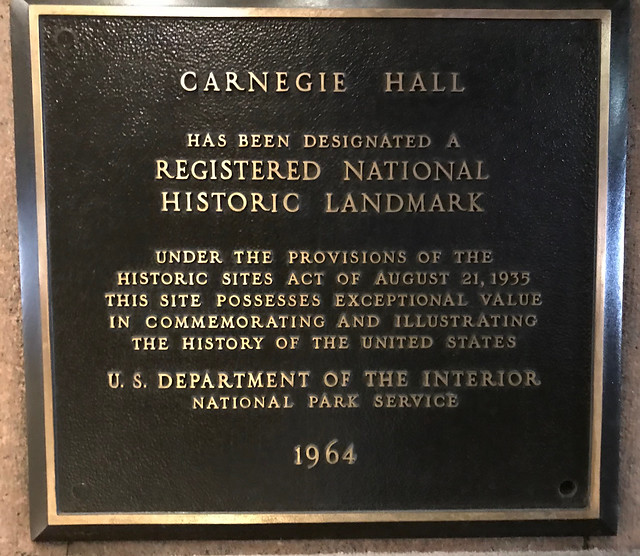
Out for a walk about on Saturday night in New York City, I wandered by Carnegie Hall.

Carnegie Hall
National Register of Historic Places #1966000535

See this location on Yahoo Maps in Flickr
See this location on Google Maps

This church is located on 7th Avenue between 56th and 57th Streets, New York, New York. The GPS coordinates for this location are 40° 45' 56.6" N 73° 58' 48.1" W.

You can log your visit to this landmark at waymark.com.

Carnegie Hall

Carnegie Hall is a concert venue in Midtown Manhattan in New York City, United States, located at 881 Seventh Avenue, occupying the east stretch of Seventh Avenue between West 56th Street and West 57th Street, two blocks south of Central Park.

Designed by architect William Burnet Tuthill and built by philanthropist Andrew Carnegie in 1891, it is one of the most prestigious venues in the world for both classical music and popular music. Carnegie Hall has its own artistic programming, development, and marketing departments, and presents about 250 performances each season. It is also rented out to performing groups. The hall has not had a resident company since 1962, when the New York Philharmonic moved to Lincoln Center's Philharmonic Hall (renamed Avery Fisher Hall in 1973 and David Geffen Hall in 2015).

Carnegie Hall has 3,671 seats, divided among its three auditoriums. Carnegie Hall presented about 200 concerts in the 2008–2009 season, up 3 percent from the previous year. Its stages were rented for an additional 600 events in the 2008–2009 season.


Carnegie Hall

Monday, May 14, 2018

Lambs Club

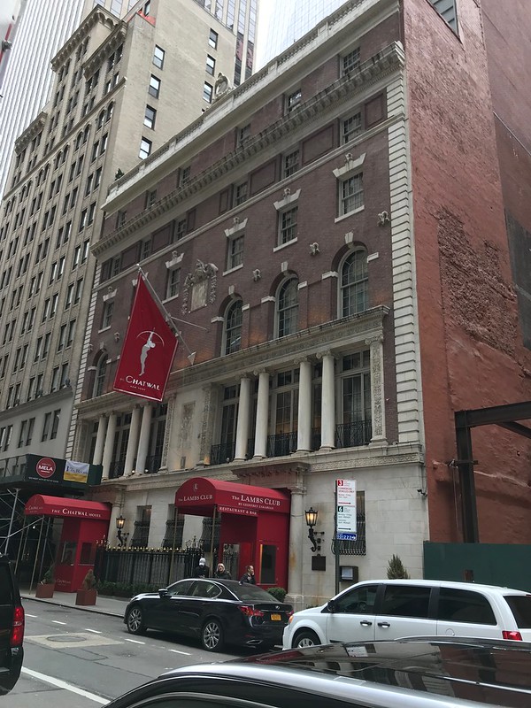
Sharon, Jack and I had brunch at the Lambs Club on Easter.

Lambs Club
Also known as Church of the Nazarene

National Register of Historic Places #1982003382

See this location on Yahoo Maps in Flickr
See this location on Google Maps

This building is located at 128 West 44th Street, New York, New York. The GPS coordinates for this location are 40° 45' 23.9" N 73° 59' 04.1" W.

The Lambs Club

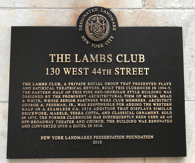
The Lambs Club, a private social group that presented plays and satirical theatrical revues, built this clubhouse in 1904-05. The Eastern half of the this fine Neo-Georgina style building was designed by the prominent architectural firm of McKim, Mead & White, whose senior partners were club members. Architect George A. Freeman, Jr., was responsible for adding the Western half in a seamless ca. 1915 addition that displays similar brickwork, marble, terra cotta, and classical ornament. Sold in 1975, the former clubhouse has subsequently been used as an off-broadway theater and church. The building was renovated and converted into a hotel in 2010.

The Lambs Club

Wednesday, May 02, 2018

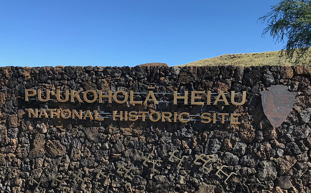
Puʻukoholā Heiau National Historic Site

Sharon and I visited Puʻukoholā Heiau when we were on the Big Island for Becky's wedding.

Pu'ukohola Heiau
National Register of Historic Places #196607001173

See this location on Yahoo Maps in Flickr
See this location on Google Maps

This church is located at 62-3601 Kawaihae Road, Kawaihae, Hawaii. The GPS coordinates for this location are N 20° 01.592 W 155° 49.203.

You can log your visit to this landmark at waymark.com.

Puʻukoholā Heiau

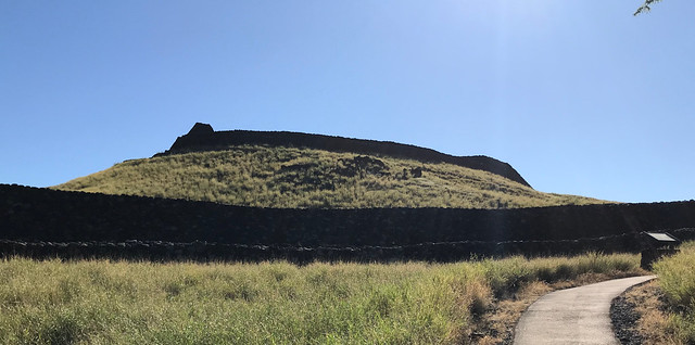
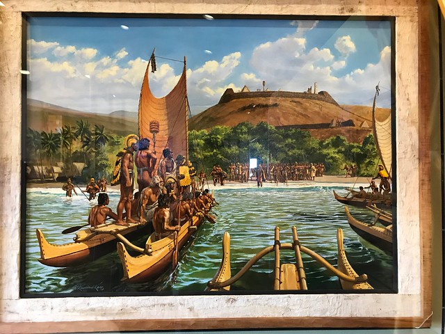
This National Historic Site is home to one of the largest restored heiau (temple) in Hawaii and is part of the National Park System. Heiau were sacred places of worship for Native Hawaiians, and Puukohola Heiau was a site built to fulfill a historic prophecy.

North Kohala-born Kamehameha the Great was advised by his kahuna (priest) to build and dedicate Puukohola Heiau to the war god Kukailimoku to help in his efforts to unite the Hawaiian Islands. The fortress-like heiau was constructed overlooking the Kohala Coast between 1790 and 1791. King Kamehameha ultimately fulfilled the kahuna’s prophecy when he united the Hawaiian Islands in 1810.

Puʻukoholā Heiau

This massive stone temple was built without the use of mortar. It is also believed that the lava rocks used to build the structure were passed hand-by-hand in a human chain all the way from Pololu Valley, some 25 miles away. The 224 by 100-foot structure is surrounded by 16- to 20-foot walls and has been carefully preserved and restored. It is believed to be one of the last sacred structures built in the Hawaiian Islands before western influence. Puukohola, which means “hill of the whale” in Hawaiian.

Puʻukoholā Heiau National Historic Site

Monday, April 16, 2018

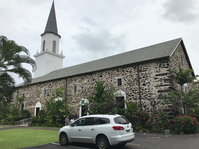
Mokuaikaua Church

Sharon and I visited the Mokuaikaua Church when we were on the Big Island for Becky's wedding.

Mokuaikaua Church
National Register of Historic Places #1978001015

See this location on Yahoo Maps in Flickr
See this location on Google Maps

This church is located at 75-5713 Ali'i Drive, Kailua-Kona, Hawaii. The GPS coordinates for this location are N 19° 38.364 W 155° 59.636.

You can log your visit to this landmark at waymark.com.

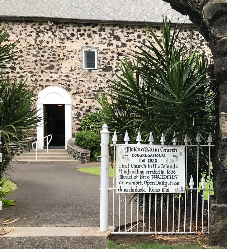
Mokuaikaua Church, located on the Big Island of Hawaii, is the oldest Christian church in the Hawaiian Islands. The congregation dates to 1820 and the building was completed in 1837.

Mokuaikaua Church

Mokuaikaua Church

Saturday, April 07, 2018

Kamakahonu

Sharon and I wandered through Kamakahonu when we were on the Big Island for Becky's wedding.

Kamakahonu
National Register of Historic Places #1966000288

See this location on Yahoo Maps in Flickr
See this location on Google Maps

This marker is located on northwest edge of Kailua Bay, north and west of Kailua Wharf, Kailua-Kona, Hawaii. The GPS coordinates for this location are N 19° 38.349 W 155° 59.867.

You can log your visit to this landmark at waymark.com.

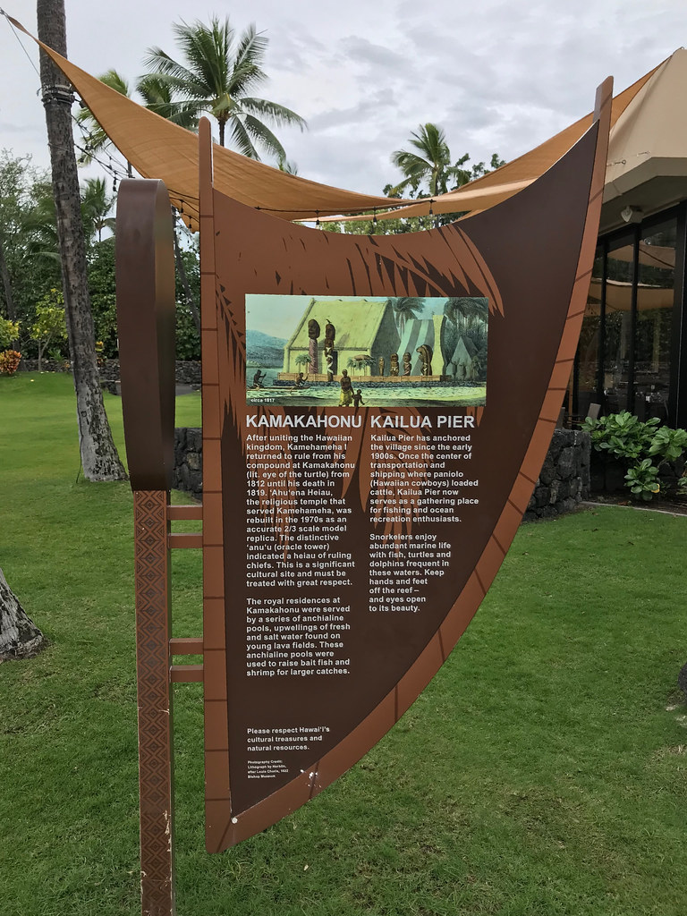
Kamakahonu, the residence of Kamehameha I, is located at the north end of Kailua Bay in Kailua-Kona on the Island of Hawai'i. At one time the residential compound included 'Ahu'ena Heiau, the personal heiau (place of worship) of Kamehameha I, thatched houses for ali'i (chiefs) and women, an enclosing wall, Hale Nana Mahina'ai (the personal retreat of Kamehameha I) work sheds, storehouses, and other buildings.

Kamakahonu


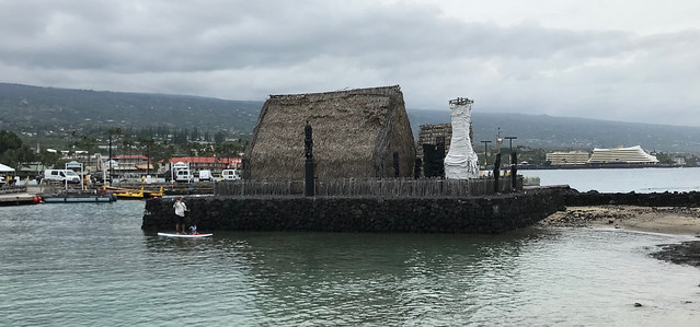
After uniting the Hawaiian kingdom, Kamehameha I returned to rule from his compound at Kamakahonu (lit. eye of the turtle) from 1812 until his death in 1819. Ahu'ena Heiau, the religious temple that served Kamehameha, was rebuilt in the 1970s as an accurate 2/3 scale model replica. The distinctive anu'u (oracle tower) indicated a heiau of ruling chiefs. This is a significant cultural site and must be treated with great respect.

The royal residences at Kamakahonu were served by a series of anchialine pools, upwillings of fresh and salt water found on young lava fields. These anchialine pools were used to raise balt fish and shrimp for larger catches.


Ahu'ena Heiau, the religious temple that served Kamehameha, was rebuilt in the 1970s as an accurate 2/3 scale model replica.

Ahu'ena Heiau

Monday, March 26, 2018

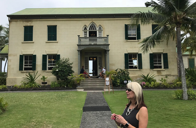
Hiluhe'e Palace

Sharon and I toured the Hulihee Palace when we were on the Big Island for Becky's wedding.

Hulihe'e Palace
National Register of Historic Places #1973000653

See this location on Yahoo Maps in Flickr
See this location on Google Maps

This marker is located at 75-5718 Ali'i Drive, Kailua-Kona, Hawaii. The GPS coordinates for this location are 19° 38' 21.7" N 155° 59' 39.1" W.

You can log your visit to this landmark at waymark.com.

Hulihee Palace

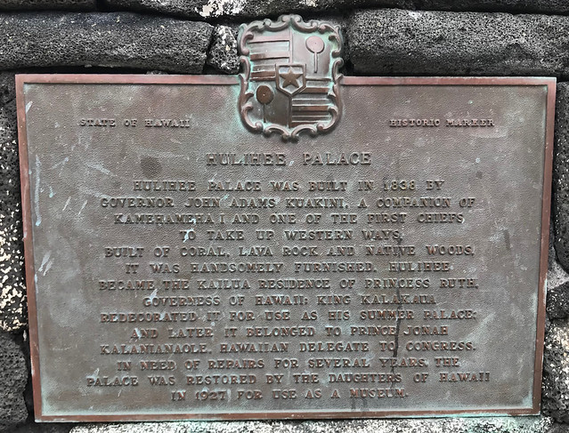
Hulihe’e Palace was built in 1838 by Governor John Adams Kuakini, a companion of Kamehameha I and one of the first chiefs to take up western ways. Built of coral, lava rock and native woods, it was handsomely furnished. Hulihe’e became the Kailua residence of Princess Ruth, Governess of Hawaii. King Kalakaua redecorated it for use as his summer palace and later it belonged Prince Jonah Kalaniana’ole, Hawaiian delegate to Congress. In need of repairs for several years, the palace was restored by the Daughters of Hawaii in 1927 for use as a museum.

Hulihee Palace

Tuesday, March 06, 2018

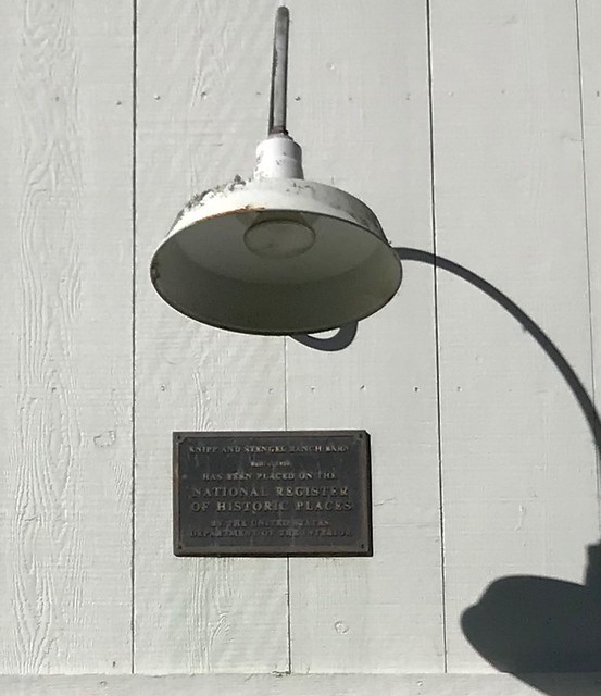
Knipp and Stengel Ranch Barn

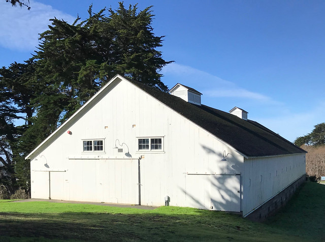
I wandered by this building while we were hiking in Sea Ranch.

Knipp and Stengel Ranch Barn
Also known as Sea Ranch Stables

National Register of Historic Places #1987000005

See this location on Yahoo Maps in Flickr
See this location on Google Maps

This marker is located at the intersection of Highway 1 and Wild Iris, Sea Ranch, California. The GPS coordinates for this location are N 38° 42.990 W 123° 27.392.

You can log your visit to this landmark at waymark.com.

Knipp and Stengel Ranch Barn

The Knipp and Stengel Ranch Barn (Sea Ranch Stable) is a large wood frame structure utilizing mortise and tenon construction. Built in the mid-1880s, the barn is the major structure remaining on the 4.38-acre remnant of the once-larger ranch. Also within the boundaries are an early (pre-1906) hay barn, a 1920s scale house, and a 1920s equipment building; these wood frame utilitarian structures contribute to the overall character of the property. An early barn (known also as the machine shop), built prior to the 1880s, recently collapsed; it has been removed and no longer contributes to the complex. The main barn has undergone some interior alterations and minor window changes, but remains largely intact.

Knipp and Stengel Ranch Barn

Wednesday, March 29, 2017

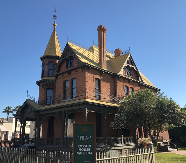
Rosson House

I stopped at Heritage Square and the Rosson House briefly after dropping Tomasin at the airport.

Rosson House
National Register of Historic Places #1971000112
Arizona Historical Marker

See this location on Yahoo Maps in Flickr
See this location on Google Maps

This historic place is located at 139 North 6th Street, Phoenix, Phoenix in the county of Maricopa, Arizona. The GPS coordinates for this location are N 33° 27.001 W 112° 03.962.

You can log your visit to this landmark at waymark.com.

Rosson House

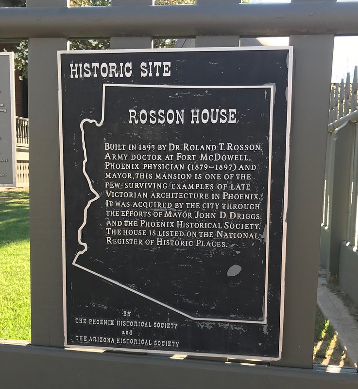
Built in 1895 by Dr. Roland T. Rosson, Army doctor at Fort McDowell. Phoenix physician (1879-1892) and mayor. This mansion is one of the few surviving examples of late Victorian architecture in Phoenix. It was acquired by the city through the efforts of Mayor John D. Driggs and the Phoenix Historical Society. The house is listed on the National Register of Historic Places.

By the Phoenix Historical Society and the Arizona Historical Society


Rosson House

Wednesday, November 16, 2016

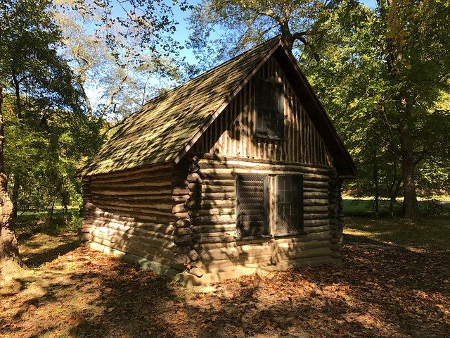
Joaquin Miller Cabin

Sharon and I stopped briefly at the Joaquin Miller Cabin while we were hiking in Rock Creek Park.

Joaquin Miller Cabin
contributing property to the
Rock Creek Park Historic District

National Register of Historic Places #1991001524

See this location on Yahoo Maps in Flickr
See this location on Google Maps

This building is located on the east bank of Rock Creek one half mile north of Military Road in Washington, DC. The GPS coordinates for this location are 38° 57' 50.2" N 77° 02' 46.7" W.

Joaquin Miller Cabin


The Joaquin Miller Cabin is an historic structure situated in Washington, DC's Rock Creek Park. Built by the American poet, essayist and fabulist Joaquin Miller, it represents the only known example of late 19th century Rustic-style log cabin in Washington, D.C.

In 1883, Joaquin Miller (1837–1913) moved to Washington, DC to get involved in politics. He built the cabin near the intersection of 16th and Belmont Streets, NW across from present day Meridian Hill Park to find rustic peace and "find his muse". Miller is known to have occupied the cabin from 1883 to late 1885 when he left for California.

In 1911, the area near Meridian Hill Park was being developed and Henry White, the former ambassador to France, was building an estate on land that included the cabin. The state of California and the Columbia Historical Society sought to save the structure from demolition and have it moved to Rock Creek Park. The board of the National Park Service refused the request but Senator John D. Works, and Joseph R. Knowland of California successfully intervened to force the Park Service to move the cabin to its present location near the east bank of Rock Creek one half mile north of Military Road.

Wednesday, January 27, 2016

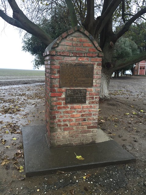
Grand Island Shrine

Grand Island Shrine
Also known as The Little Shrine at Sycamore

National Register of Historic Places #1974000508

See this location on Yahoo Maps in Flickr
See this location on Google Maps

This marker is located 8 miles south of Colusa on CA 45, Colusa, California. The GPS coordinates for this location are 39° 06' 56.9" N 121° 56' 12.6" W.

Grand Island Shrine

Grand Island Shrine

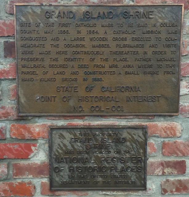
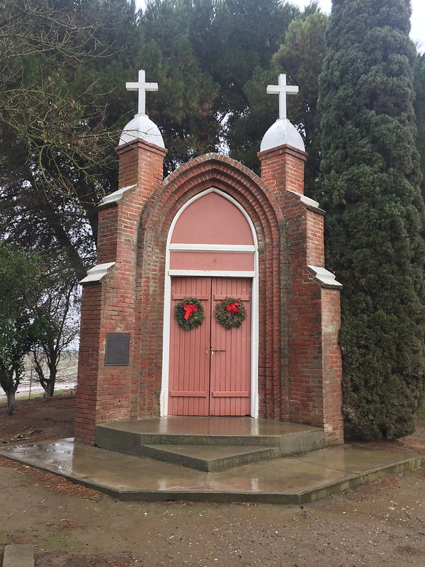
Site of the first Catholic mass to be said in Colusa County, May 1856. In 1864, a Catholic mission was conducted and a large wooden cross erected to commemorate the occasion. Masses, pilgrimages and visits were made here continuously thereafter. In order to preserve the identity of the place, Father Michael Wallrath secured a deed from Mrs. Anna Myers to this parcel of land and constructed a small shrine from hand kilned bricks in 1883.
State of California
Point of Historical Interest
No. COL-001

Grand Island Shire

Grand Island Shire

Tuesday, October 13, 2015

Larkmead Winery - Kornell Cellars

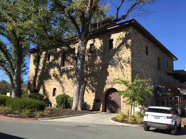
Sharon and I stopped at this winery on our 2015 anniversary trip. The Larkmead Winery is the third oldest winery in the Napa Valley. The Charles Krug Winery is credited as being the oldest operating winery in the Napa Valley.

Larkmead Winery
Also known as Hanns Kornell Champagne Cellars

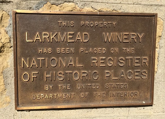
National Register of Historic Places #1982002215

See this location on Yahoo Maps in Flickr
See this location on Google Maps

This marker is located at 1091 Larkmead Lane, Calistoga, California. The GPS coordinates for this location are 38° 33' 31.9" N 122° 31' 21.3" W.

You can log your visit to this landmark at waymark.com.

Larkmead

Larkmead

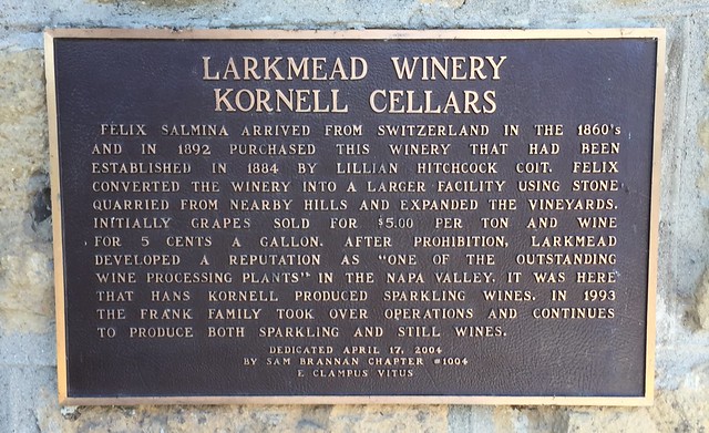
Felix Salmina arrived from Switzerland in the 1860's and in 1892 purchased this winery that had been established in 1884 by Lillian Hitchcock Coit. Felix converted the winery into a larger facility using stone quarried from nearby hills and expanded the vineyards. Initially grapes sold for $5.00 per ton and wine for 5 cents a gallon. After prohibition, Larkmead developed a reputation as "one of the outstanding wine processing plants" in the Napa Valley. It was here that Hans Kornell produced sparkling wines. In 1993 the Frank family took over the operations and continues to produce both sparkling and still wines.


Dedicated April 17, 2004
By Sam Brannan Chapter #1004
E Clampus Vitus

Larkmead Winery

Tuesday, August 25, 2015

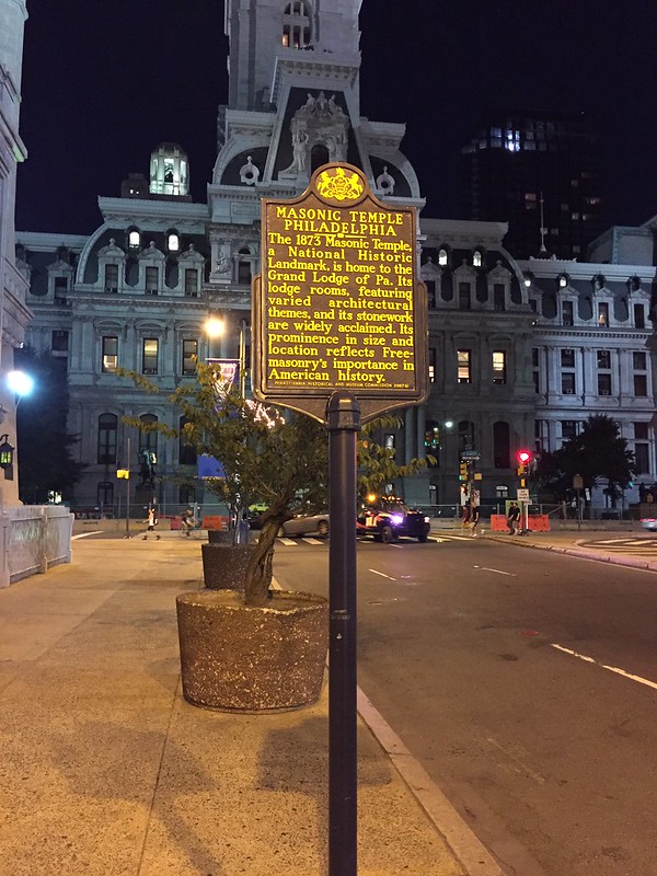
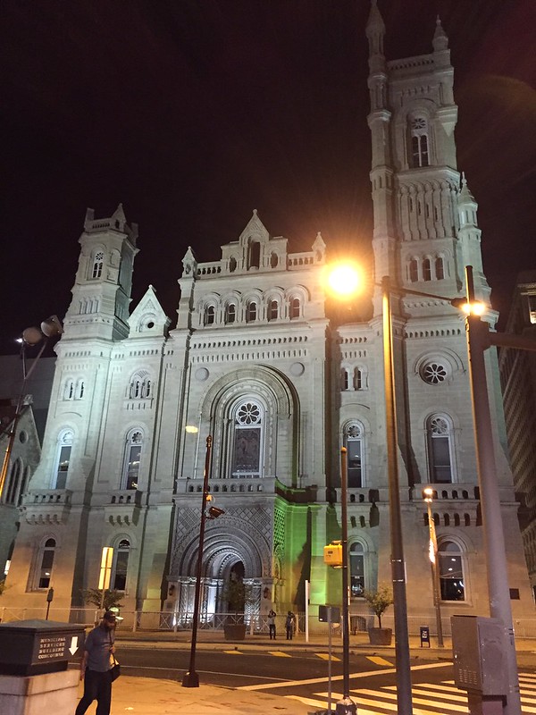
Masonic Temple Philadelphia

After dinner on the first day of the East Coast College Tour, Sharon and I wandered by this waymark exploring the area around Penn Square and city hall.

Masonic Temple Philadelphia
Pennsylvania Historical Marker
National Register of Historic Places #1971000727

See this location on Yahoo Maps in Flickr
See this location on Google Maps

This marker is located at 55 North Broad Street, Pennsylvania. The GPS coordinates for this location are N N 39° 57.226 W 075° 09.790.

You can log your visit to this landmark at waymark.com.

Masonic Temple Philadelphia

The 1873 Masonic Temple, a National Historic Landmark, is home to the Grand Lodge of Pa. Its lodge rooms, featuring varied architectural themes, and its stonework are widely acclaimed. Its prominence in size and location reflects Free-masonry’s importance in American history.

Masonic Temple Philadelphia

Thursday, December 13, 2012

Barboursville

Sharon, Jack and I stopped at the Barboursville Vineyards after visiting Montecello.

Barboursville
National Register of Historic Places #1969000267

See this location on Yahoo Maps in Flickr
See this location on Google Maps

This site is located south of the junction of Routes 777 and 678, Barboursville, Virginia. The GPS coordinates for this location are N 38° 09.738 W 078° 16.843.

You can log your visit to this landmark at waymark.com.

Barboursville

Barboursville is the ruin of the estate of former U.S. Senator, U.S. Secretary of War, and Virginia Governor James Barbour. The house was designed by Barbour's friend and political ally, Thomas Jefferson. Until it burned on Christmas day, 1884, Barbour's house stood essentially as completed from designs by Thomas Jefferson. Jefferson designed the house in the then fashionable Neo-Palladian style.

During the fire of 1884 everything except the exterior brick walls, the interior masonry partitions, and the columns of the porticoes perished. The ruins have been stabilized and are maintained as a tourist attraction.

The ruin is now owned by Barboursville Vineyards and sits within the winery's property. Visitors to the winery can visit the ruins. On summer evenings, theatrical and musical productions are presented at the ruin.

Barboursville
Barboursville

Monday, July 11, 2011

Theodore Roosevelt Island National Memorial

On Friday afternoon when we were in Washington D.C., Jack and I rode bikes out to the Theodore Roosevelt Island National Memorial. I have read a number of books on Teddy Roosevelt and I am fascinated by all of the things that he accomplished in his relatively short life.

Theodore Roosevelt Island National Memorial
National Register of Historic Places #1966000869

See this location on Yahoo Maps in Flickr
See this location on Google Maps

This historic place is located south of the Key Bridge in the Potomac River in the District of Columbia. The GPS coordinates for this location are N 38° 53.845 W 077° 03.838.

You can log your visit to this landmark at waymark.com.

Theodore Roosevelt Island National Memorial

In 1931, the Theodore Roosevelt Memorial Association purchased the island from the gas company with the intention of erecting a memorial honoring Roosevelt. Congress authorized the memorial on May 21, 1932, but did not appropriate funds for the memorial for almost three decades.

Funds were finally designated by Congress in 1960. The memorial was dedicated on October 27, 1967. Designed by Eric Gugler, the memorial includes a 17-foot statue by sculptor Paul Manship, four large stone monoliths with some of Roosevelt's more famous quotations, and two large fountains.

Theodore Roosevelt Island National Memorial

Sunday, May 08, 2011

Zion National Park South Entrance Sign

Zion National Park
South Entrance Sign

National Register of Historic Places #1986003713

See this location on Yahoo Maps in Flickr
See this location on Google Maps

This historic place is located at 201 Zion Park Boulevard, Springdale, in the county of Washington, Utah. The GPS coordinates for this location are N 37° 12.078 W 112° 59.313.

You can log your visit to this landmark at waymark.com.

Zion National Park South Entrance Sign

The sign consists of two locally-quarried red sandstone pillars flanking the south entrance road to Zion National Park, with a horizontal log projecting from one pylon supporting a sign. The sign was designed by the National Park Service Branch of Plans and Designs in 1936 and was built by Civilian Conservation Corps labor from Camp NP-2. It was altered in 1940 to the design of Park Service architects H.W. Young and A.C. Kuehl. The sign reflects a consistent design theme that was developed for many park structures in Zion.


View Larger Map

Thursday, March 24, 2011

Scottsdale Grammar School

I wandered by these waymarks as we were winding our way back to buca di beppo after the Giants game.

Scottsdale Grammar School
National Register of Historic Places #1994000571
Arizona Historical Marker

See this location on Yahoo Maps in Flickr
See this location on Google Maps

This historic place is located at 7333 E. Scottsdale Mall, Scottsdale in the county of Maricopa, Arizona. The GPS coordinates for this location are N 33° 29.580 W 111° 55.416.

You can log your visit to this landmark at waymark.com.

Arizona Historical Marker - Scottsdale Grammar School

Dedicated February 26, 1910
on the 73rd birthday of Scottsdale's Founder

CHAPLAIN WINFIELD SCOTT

The building served the
people of Scottsdale as

SCHOOL
COMMUNITY CENTER
CITY HALL AND JUSTICE COURT
LIBRARY

rededicated in 1976
as a building on the State
Register of Historic Places

This plaque donated by the school children of Scottsdale


Scottsdale Historical Museum