Showing posts with label Sea Ranch Historical Markers. Show all posts

Tuesday, February 28, 2023

White Fir Wood Cluster

Sharon and I explored this Sea Ranch Architectural Marker on Day 5 of our Sea Ranch trip in July.

White Fir Wood Cluster
See this location on Yahoo Maps in Flickr
See this location on Google Maps

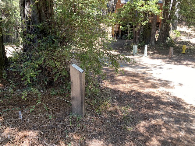
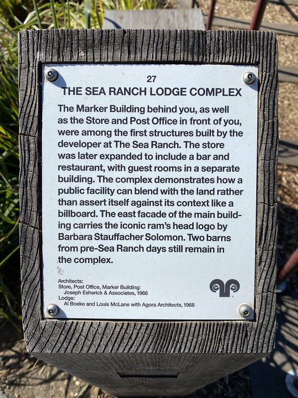
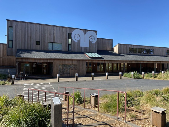
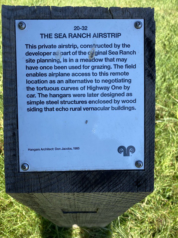
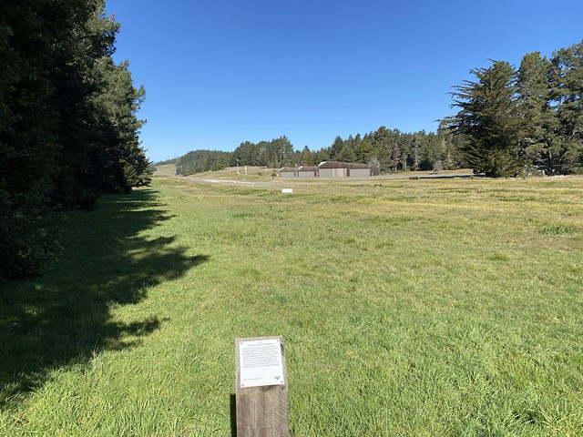
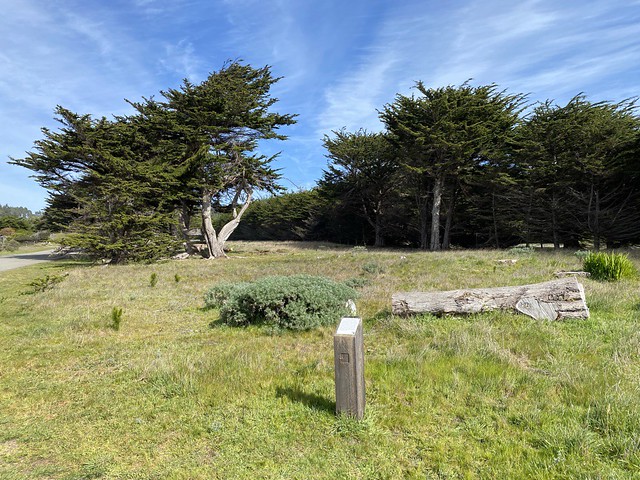
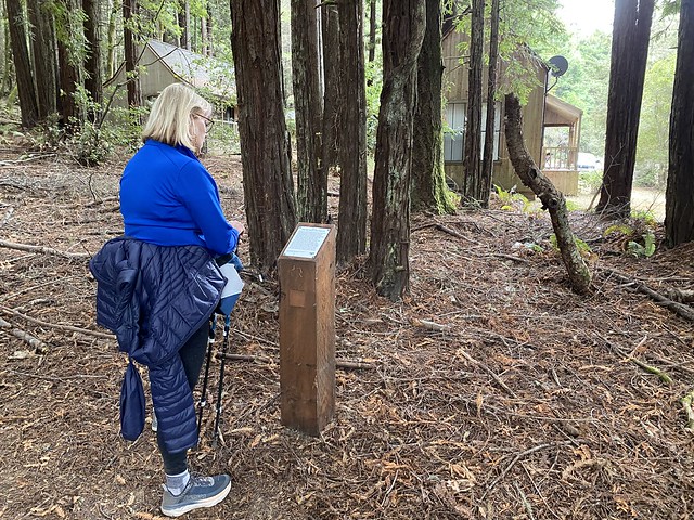
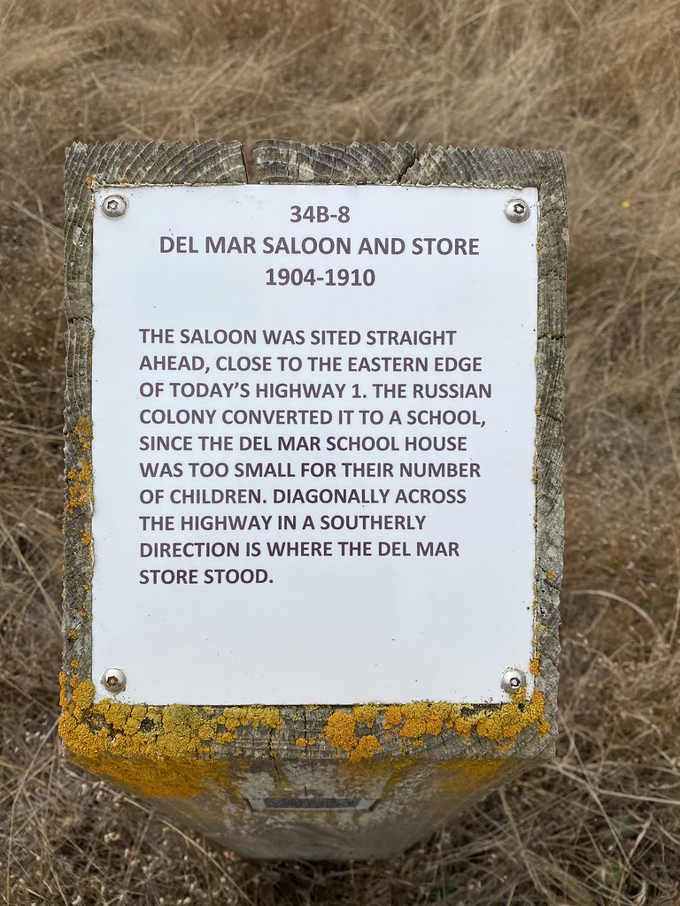
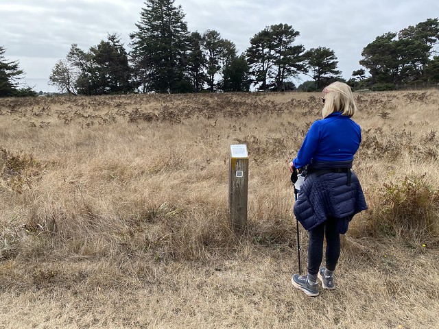
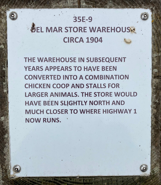
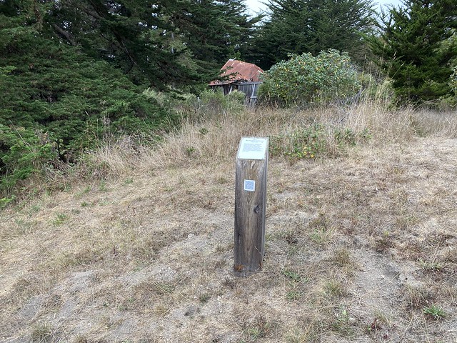
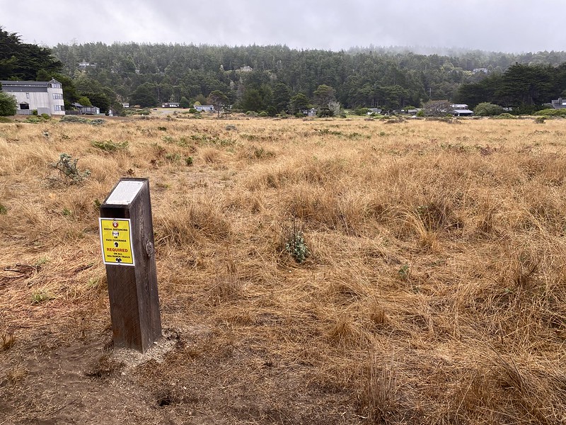
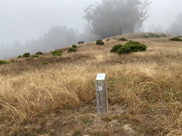
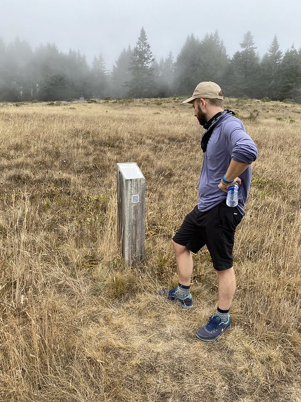
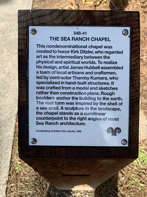
This marker is located on the Meadow Trail near Pine Meadow Road, Sea Ranch, California. The Sea Ranch Archives Committee has identified twenty-six historic sites scattered about The Sea Ranch. They have constructed trail markers with information explaining the significance of each place. They were placed as part of The Sea Ranch 50th anniversary being celebrated from Memorial Day 2014 to Memorial Day 2015. Since then, a number of architecture and landscape markers have been added. The GPS coordinates for this location are 38° 43' 10.7" N 123° 27' 20.1" W.

WHITE FIR WOOD CLUSTER

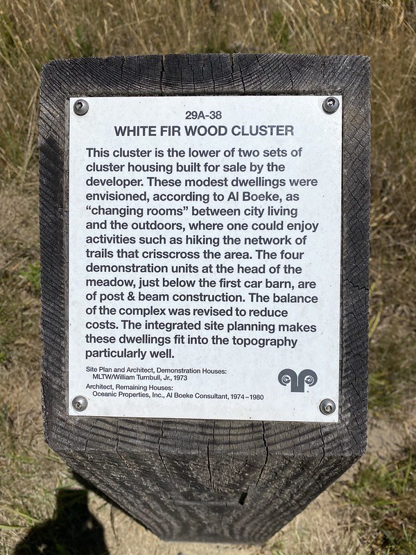
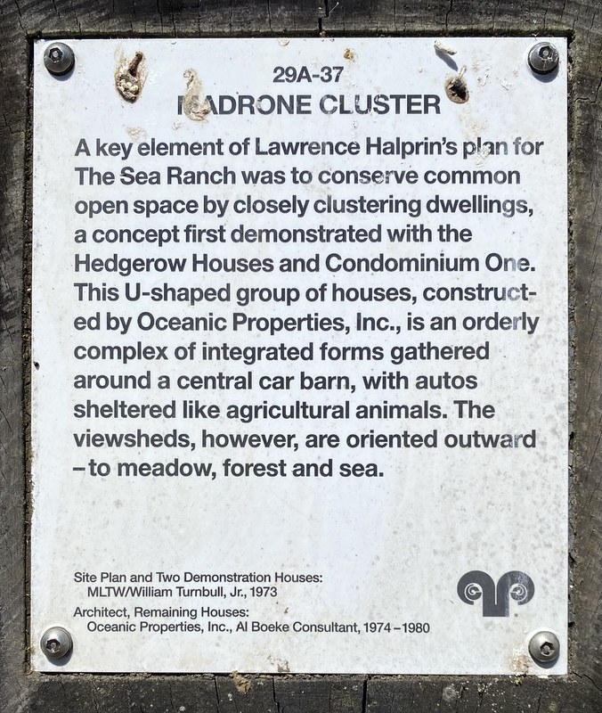
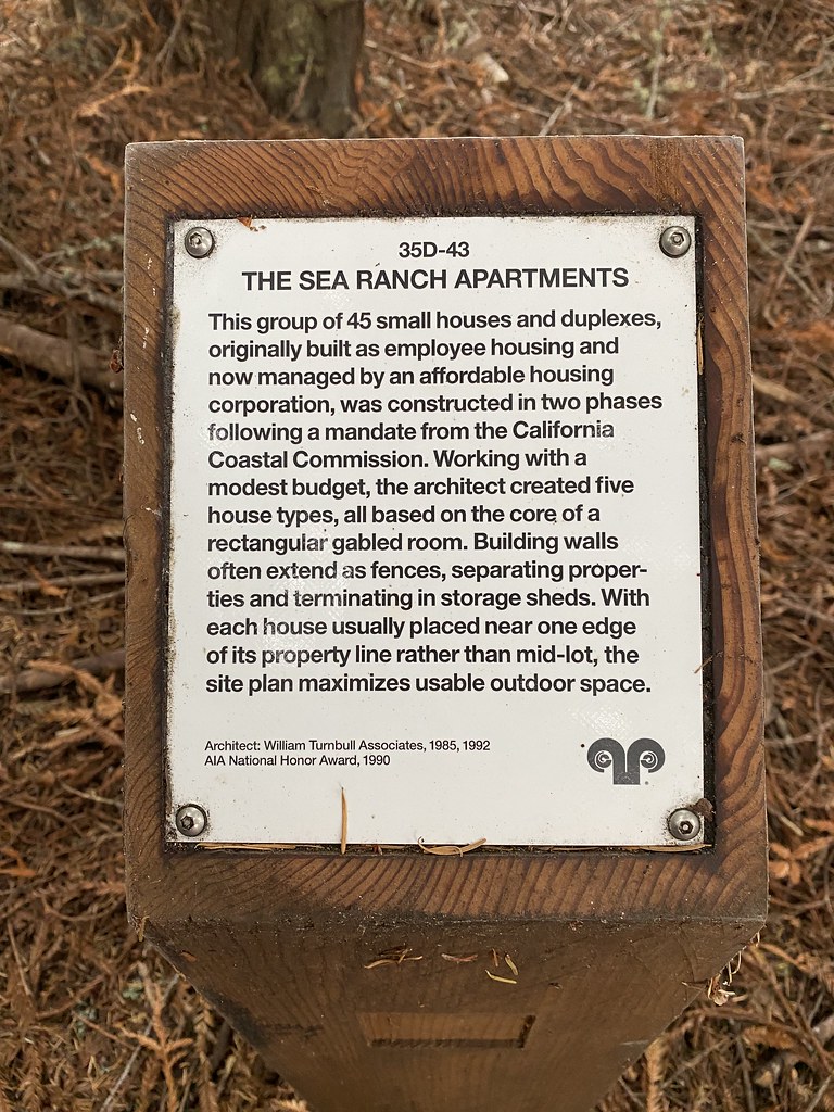
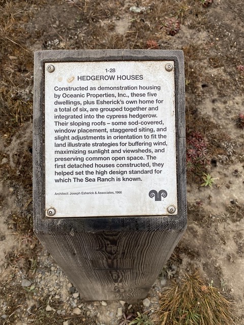
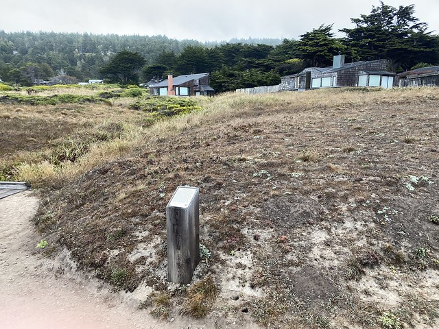
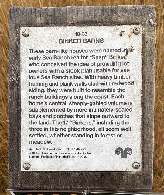
This cluster is the lower of two sets of cluster housing built for sale by the developer. These modest dwellings were envisioned, according to Al Boeke, as "changing rooms" between city living and the outdoors, where one could enjoy activities such as hiking the network of trails that crisscross the area. The four demonstration units at the head of the meadow, just below the first car barn, are of post & beam construction. The balance of the complex was revised to reduce costs. The integrated site planning makes these dwellings fit into the topography particularly well.

Site Plan and Architect, Demonstration Houses:
MLTW/William Turnbull, Jr., 1973

Architect, Remaining Houses:
Oceanic Properties, Inc., Al Boeke Consultant, 1974-1980


WHITE FIR WOOD CLUSTER

Wednesday, February 22, 2023

Madrone Cluster

Sharon and I explored this Sea Ranch Architectural Marker on Day 5 of our Sea Ranch trip in July.

Madrone Cluster
See this location on Yahoo Maps in Flickr
See this location on Google Maps

This marker is located near 320 Madrone Meadow, Sea Ranch, California. The Sea Ranch Archives Committee has identified twenty-six historic sites scattered about The Sea Ranch. They have constructed trail markers with information explaining the significance of each place. They were placed as part of The Sea Ranch 50th anniversary being celebrated from Memorial Day 2014 to Memorial Day 2015. Since then, a number of architecture and landscape markers have been added. The GPS coordinates for this location are 38° 43' 18.9" N 123° 27' 24.9" W.

Madrone Cluster

A key element of Lawrence Haprin’s plan for The Sea Ranch was to conserve common open space by closely clustering dwellings, a concept first demonstrated with the Hedgerow Houses and Condominium One. This U-Shaped group of houses, constructed by Oceanic Properties, Inc., is an orderly complex of integrated forms gathered around a central car barn, with autos sheltered like agricultural animals. The view sheds, however are oriented outward-to meadow, forest and sea.

Site and Two Demonstration Houses:
MLTW/Willima Turnbull, Jr. 1973
Architect, Remaining Houses. Oceanic Properties, Inc. Al Boeke Consultant, 1974-1980


Madrone Cluster

Tuesday, December 06, 2022

Walk-in Cabins

Sharon and I explored this Sea Ranch Architectural Marker on Day 5 of our Sea Ranch trip in July.

Walk-in Cabins
See this location on Yahoo Maps in Flickr
See this location on Google Maps

This marker is located at 278 Redwood Rise, Sea Ranch, California. The Sea Ranch Archives Committee has identified twenty-six historic sites scattered about The Sea Ranch. They have constructed trail markers with information explaining the significance of each place. They were placed as part of The Sea Ranch 50th anniversary being celebrated from Memorial Day 2014 to Memorial Day 2015. Since then, a number of architecture and landscape markers have been added. The GPS coordinates for this location are 38° 43' 15.9" N 123° 27' 17.5" W.

Walk-in Cabins

Oceanic Properties, Inc, constructed this group of 15 small, economically-built cabins as weekend getaways, with access by foot and parking at the base of the hill. The complex has the feeling of a summer base camp for nature exploration. Each cabin is 20 feet to a side, with a loft covered by a skylit flat roof on one corner from which two roof planes drop down like tent flaps. These repetitive house forms are varied by the particulars of their siting among the redwoods and on the steep slopes.

Architect: Obie Bowman, 1972
Award in Architecture and Engineering, 1972
Sea Ranch Design Award, 1974
First Honor Award, Homes for Better Living Awards Program, AIA/House and Home, 1975
AIA/Sunset "Western Home Awards" Citation, 1976


Walk-in Cabins

Tuesday, August 16, 2022

Moonraker Recreational Center

We played pickleball at the Moonraker Recreational Center on Monday and Friday when we were at The Sea Ranch in July.

Moonraker Recreational Center
See this location on Yahoo Maps in Flickr
See this location on Google Maps

This marker is located at 35336 Moonraker Road, Sea Ranch, California. The Sea Ranch Archives Committee has identified twenty-six historic sites scattered about The Sea Ranch. They have constructed trail markers with information explaining the significance of each place. They were placed as part of The Sea Ranch 50th anniversary being celebrated from Memorial Day 2014 to Memorial Day 2015. Since then, a number of architecture and landscape markers have been added. The GPS coordinates for this location are 38° 41' 18.1" N 123° 25' 38.9" W.

Moonraker Recreation Center

The defining feature of this innovative poo/tennis complex is its seamless combination of landscape and building. Earthen berms join with the wooden "wall" accommodating locker rooms to create a wind-calmed oasis. Interior "supergraphics" by Barbara Stauffacher Solomon, in large-scaled, vibrant shapes and letters, psychologically expand the tiny spaces. Recreated and refreshed in 2018, these architectural graphics were among the very first examples of graphics in this manner.

Architect: MLTW/Moore Turnbull
Landscape Architect: Lawrence Halprin, 1968
Progressive Architecture Citation, 1966
AIA Nation Honor Award, 1968


Moonraker Recreation Center

Wednesday, April 20, 2022

The Sea Ranch Lodge Complex

We had dinner with the Larkins on on Day 8 of our Sea Ranch trip. After being closed for several years, we are glad to see the lodge back open!

The Sea Ranch Lodge Complex
See this location on Yahoo Maps in Flickr
See this location on Google Maps

This marker is located at 60 Sea Walk Drive, Annapolis, California. The Sea Ranch Archives Committee has identified twenty-six historic sites scattered about The Sea Ranch. They have constructed trail markers with information explaining the significance of each place. They were placed as part of The Sea Ranch 50th anniversary being celebrated from Memorial Day 2014 to Memorial Day 2015. Since then, a number of architecture and landscape markers have been added. The GPS coordinates for this location are 38° 40' 49.7" N 123° 25' 44.1" W.

The Sea Ranch Lodge Complex

The Marker Building behind you, as well as the Store and Post Office in front of you, were among the first structures built by the developer of The Sea Ranch. The store was later expanded to include a bar and restaurant, with guest rooms in a separate building. The complex demonstrates how a public facility can blend with the land rather than assert itself against the context like a billboard. The east facade of the main building carries the iconic ram's head logo by Barbara Stauffacher Solomon. Two barns from pre-Sea Ranch days still remain in the complex.

The Sea Ranch Lodge Complex

Monday, April 11, 2022

The Sea Ranch Airstrip

We passed this marker on our hike with the Larkins on on Day 8 of our Sea Ranch trip.

The Sea Ranch Airstrip
See this location on Yahoo Maps in Flickr
See this location on Google Maps

This marker is located on the Airstrip Trail along Annapolis Road, Sea Ranch, California. The Sea Ranch Archives Committee has identified twenty-six historic sites scattered about The Sea Ranch. They have constructed trail markers with information explaining the significance of each place. They were placed as part of The Sea Ranch 50th anniversary being celebrated from Memorial Day 2014 to Memorial Day 2015. Since then, a number of architecture and landscape markers have been added. The GPS coordinates for this location are 38° 42' 02.6" N 123° 25' 41.8" W.

The Sea Ranch Airstrip

This private airstrip, constructed by the developer as part of the original Sea Ranch site planning, is a meadow that may have once been used for grazing. The field enables airplane access to this remote location as an alternative to negotiating the tortuous curves of Highway One by car. The hangers were later designed as simple steel structures enclosed by wood siding that echo rural vernacular buildings.

The Sea Ranch Airstrip

Friday, March 11, 2022

Signature Hedgerows

On our recent trip to Sea Ranch, I got an updated trail map. It shows a number of markers that weren't shown on my 2014 50th Anniversary map. This marker was literally across the street from the house that we rented.

Signature Hedgerows
Marker 3-31

See this location on Yahoo Maps in Flickr
See this location on Google Maps

This marker is across the street from 55 Galleons Reach, Sea Ranch, California. The Sea Ranch Archives Committee has identified twenty-six historic sites scattered about The Sea Ranch. They have constructed trail markers with information explaining the significance of each place. They were placed as part of The Sea Ranch 50th anniversary being celebrated from Memorial Day 2014 to Memorial Day 2015. Since then, a number of architecture and landscape markers have been added. The GPS coordinates for this location are 38° 41' 28.9" N 123° 26' 07.5" W.

Signature Hedgerows

A few years after Walter Frick acquired the Del Mar Ranch in 1912, he began planting double rows of Monterey Cypress to divide the land into saleable "ranchettes" of 200-250 acres each. After he decided against subdividing, the trees served as wndbreaks for grazing animals. These 19 hedgerows were the most prominent landscape element when Oceanic Properties, Inc. purchased the ranch. As the original cypress trees reach the end of their lifespan, the hedgerows are being replaced with a similar double row layout as has happened here.

Signature Hedgerows

Wednesday, January 27, 2021

Central Timber Production Zone (CTPZ)

Hiking with the Gainsleys in October, we came across this historical marker. I am sure that it wasn't there when we hiked the same area with the Sanborns in 2018.

Central Timber Production Zone (CTPZ)
See this location on Yahoo Maps in Flickr
See this location on Google Maps

This marker is located on the SAG Ponds Trail east of 37268 Schooner Drive, Sea Ranch, California. The Sea Ranch Archives Committee has identified twenty-six historic sites scattered about The Sea Ranch. They have constructed trail markers with information explaining the significance of each place. They were placed as part of The Sea Ranch 50th anniversary being celebrated from Memorial Day 2014 to Memorial Day 2015. The GPS coordinates for this location are 38° 43' 09.1" N 123° 26' 50.9" W.


This portion of the ranch land, originally purchased for development by Oceanic Properties, Inc., along with the forested areas to the north and south, was sold to a timber production company in 1986 and selectively logged. The central section was subsequently repurchased by The Sea Ranch in 1992 and dedicated as commons. These 282 acres are now managed by the The Sea Ranch Association and contain a number of hiking trials. Notable are the "fairy rings" of redwoods and the nearby sag ponds.

Wednesday, January 20, 2021

The Sea Ranch Apartments

Sharon and I came across this Sea Ranch Historical Marker while we were hiking in October. It is located in the far Northeastern edge of the community on a little used trail.

The Sea Ranch Apartments
Marker 35D-43

See this location on Yahoo Maps in Flickr
See this location on Google Maps

This marker is located on the Pomo Hillside Trail near 371 Haversack, Sea Ranch, California. The Sea Ranch Archives Committee has identified twenty-six historic sites scattered about The Sea Ranch. They have constructed trail markers with information explaining the significance of each place. They were placed as part of The Sea Ranch 50th anniversary being celebrated from Memorial Day 2014 to Memorial Day 2015. The GPS coordinates for this location are 38° 45' 33.4" N 123° 30' 41.1" W.

The Sea Ranch Apartments

This group of 45 small houses nnd duplexes, originally built as employee housing and now managed. by an affordable housing corporation, was constructed in two phases following a mandate from the California Coastal Commission. Working with a modest budget, the architect created five house types, all based on the core of a rectangular gabled room. Building walls often extend as fences, separating properties and terminating in storage sheds. With each house usually placed near one edge of its property line rather than mid-lot, the site plan maximizes usable outdoor space.

The Sea Ranch Apartments

Tuesday, January 12, 2021

Riparian Passage: Salal Creek

Riparian Passage: Salal Creek
Marker 35A-44

See this location on Yahoo Maps in Flickr
See this location on Google Maps

This marker is located on the Bluff Trail near 384 Main Sail, Sea Ranch, California. The Sea Ranch Archives Committee has identified twenty-six historic sites scattered about The Sea Ranch. They have constructed trail markers with information explaining the significance of each place. They were placed as part of The Sea Ranch 50th anniversary being celebrated from Memorial Day 2014 to Memorial Day 2015. The GPS coordinates for this location are 38° 44' 55.3" N 123° 31' 09.2" W.

Riparian Passage: Salal Creek

Riparian zones are the transitional areas between land and water. At The Sea Ranch, these are the banks of streams flowing from the hills in the east, through the meadows to the ocean bluffs. They form a defining feature of the natural landscape. These zones were severely overgrazed when this land was purchased in 1963. With careful husbandry, the native vegetation has rebounded to control erosion, absorb pollutants in the stormwater runoff, and provide wildlife habitat. Salal Creek is representative and the only one reaching the ocean without a substantial drop in elevation.

Riparian Passage: Salal Creek

Tuesday, December 01, 2020

Del Mar Saloon and Store

Del Mar Saloon and Store
1904-1910

Marker 34B-8

See this location on Yahoo Maps in Flickr
See this location on Google Maps

This marker is located on the Saloon Trail near 41195 Deer Trail, Sea Ranch, California. The Sea Ranch Archives Committee has identified twenty-six historic sites scattered about The Sea Ranch. They have constructed trail markers with information explaining the significance of each place. They were placed as part of The Sea Ranch 50th anniversary being celebrated from Memorial Day 2014 to Memorial Day 2015. The GPS coordinates for this location are 38° 44' 44.5" N 123° 30' 13.7" W.

Del Mar Saloon and Store

The saloon was sited straight ahead, close to the eastern edge of today's Highway 1. The Russian colony converted it to a school, since the Del Mar school house was too small for their number of children. Diagonally across the highway in a southernly direction is where the Del Mar Store stood.

Del Mar Saloon and Store

Tuesday, November 17, 2020

Del Mar Store Warehouse

Del Mar Store Warehouse
Circa 1904

Marker 35E-9

See this location on Yahoo Maps in Flickr
See this location on Google Maps

This marker is located behind the tennis courts at the Del Mar Recreation Center, Sea Ranch, California. The Sea Ranch Archives Committee has identified twenty-six historic sites scattered about The Sea Ranch. They have constructed trail markers with information explaining the significance of each place. They were placed as part of The Sea Ranch 50th anniversary being celebrated from Memorial Day 2014 to Memorial Day 2015. The GPS coordinates for this location are 38° 44' 34.5" N 123° 30' 03.0" W.

Del Mar Store Warehouse Circa 1904

The warehouse in subsequent years appears to have been converted into a combination chicken coop and stalls for larger animals. The store would have been slightly North and much closer to where Highway 1 now runs.

Del Mar Store Warehouse Circa 1904

Tuesday, November 10, 2020

Sheep Pens

Sharon and I came across this spot when we hiked the Monarch Glen Interpretive Trail at Sea Ranch.

Sheep Pens
See this location on Yahoo Maps in Flickr
See this location on Google Maps

This marker is located on the Monarch Glen Interpretive Trail, Sea Ranch, California. The Sea Ranch Archives Committee has identified twenty-six historic sites scattered about The Sea Ranch. They have constructed trail markers with information explaining the significance of each place. They were placed as part of The Sea Ranch 50th anniversary being celebrated from Memorial Day 2014 to Memorial Day 2015. The GPS coordinates for this location are 38° 44' 01.7" N 123° 28' 51.3" W.

Monarch Glen Sheep Pens

This pattern of fields, fences, gates, pens, ramps and chutes is the only coherent remainder of the sheep industry that existed on the coastal acres of present Sea Ranch from 1916 to 1964

From pastures north (Unit 28) and south (Unit 24) sheep were herded into the west end of Monarch Glen on a mid-ranch road. Brought into this large holding field they were then selectively directed in smaller batches from one pen to another, into the dodge chute and lifted up onto the marking table. Here they were inspected, dosed, tails cropped and marked with colors.

Ewes were kept under surveillance in the ewe pens, as new lambs were a precious crop. Sheep were then directed back into adjacent pastures or up onto the loading chute to be moved to other destinations.


Monarch Glen Sheep Pens

Monday, October 05, 2020

The Sea Ranch Design Concept

This is one of two newer historical markers that I came upon on my Tuesday morning run at Sea Ranch in September. I think that they must have been placed in the last two years.

The Sea Ranch Design Concept
Marker 1-29

See this location on Yahoo Maps in Flickr
See this location on Google Maps

This marker is located on the Bluff Trail near the end of Brigantine Reach, Sea Ranch, California. The Sea Ranch Archives Committee has identified twenty-six historic sites scattered about The Sea Ranch. They have constructed trail markers with information explaining the significance of each place. They were placed as part of The Sea Ranch 50th anniversary being celebrated from Memorial Day 2014 to Memorial Day 2015. The GPS coordinates for this location are 38° 41' 10.5" N 123° 25' 53.5" W.

The Sea Ranch Design Concept

This meadow, the first planned for development at The Sea Ranch, has taken on "iconic" status. Integrated structures and landscape embody basic design concepts originated by landscape architect Lawrence Halprin and the consultant team for the developer, Oceanic Properties, Inc. Houses are set at the meadow's edge near existing hedgerows for wind protection. Clustering homes maximizes the central meadow as common open space, allowing expansive views for each residence, not just those nearest the bluff. Hillside houses are inconspicuously sited at forest edge. The simple design of the houses reflects the influence of north coast vernacular architecture, and adapts to local climatic conditions. (1963-1965)

The Sea Ranch Design Concept

Thursday, October 01, 2020

Hedgerow Houses

This is one of two newer historical markers that I came upon on my Tuesday morning run at Sea Ranch in September. I think that they must have been placed in the last two years.

Hedgerow Houses
Marker 1-28

See this location on Yahoo Maps in Flickr
See this location on Google Maps

This marker is located on the Bluff Trail near the end of Black Point Reach, Sea Ranch, California. The Sea Ranch Archives Committee has identified twenty-six historic sites scattered about The Sea Ranch. They have constructed trail markers with information explaining the significance of each place. They were placed as part of The Sea Ranch 50th anniversary being celebrated from Memorial Day 2014 to Memorial Day 2015. The GPS coordinates for this location are 38° 41' 05.0" N 123° 25' 53.6" W.

Hedgerow Houses

Constructed as demonstration housing by Oceanic Properties, Inc., these five dwellings, plus Esherick's own home for a total of six, are grouped together and integrated into the cypress hedgerow. Their sloping roofs - some sod-covered, window placement, staggered siting, and slight adjustments in orientation to fit the land illustrate the strategies for buffering wind, maximizing sunlight and viewsheds, and preserving common open space. The first detached houses constructed, they helped set the high design standard for which The Sea Ranch is known.

Hedgerow Houses

Tuesday, September 22, 2020

Logging Techniques

While we were at Sea Ranch in August, Drew, Jack, Sharon and I hiked from the rental over the ridge to the Gualala River. A map of the hike is here.  This is one of two historical markers that we came upon.

Logging Techniques
Marker 25A-23

See this location on Yahoo Maps in Flickr
See this location on Google Maps

This marker is located at the end of River Beach Road, Sea Ranch, California. The Sea Ranch Archives Committee has identified twenty-six historic sites scattered about The Sea Ranch. They have constructed trail markers with information explaining the significance of each place. They were placed as part of The Sea Ranch 50th anniversary being celebrated from Memorial Day 2014 to Memorial Day 2015. The GPS coordinates for this location are 38° 42' 23.0" N 123° 25' 28.2" W.

Logging Techniques

The Gualala River and its tributaries transported logs down to the river's mouth where the Gualala Mill was located. Logging trains followed the river's course and ran up the ravines to the tributaries, collecting logs and transporting them back down to the mill. A hike along the San Andreas Fault Interpretive Trail reveals a logging road, skid trails and large stumps featuring notches cut for the springboards of lumber jacks.

Logging Techniques

Wednesday, September 16, 2020

Knipp-Stengel Era

I went looking for this historical marker during one of my runs when we were in Sea Ranch in August.

Knipp-Stengel Era
Marker 40-20

See this location on Yahoo Maps in Flickr
See this location on Google Maps

This marker is located on the Longmeadow Trail near market #253, Sea Ranch, California. The Sea Ranch Archives Committee has identified twenty-six historic sites scattered about The Sea Ranch. They have constructed trail markers with information explaining the significance of each place. They were placed as part of The Sea Ranch 50th anniversary being celebrated from Memorial Day 2014 to Memorial Day 2015. The GPS coordinates for this location are 38° 42' 57.7 N 123° 27' 10.9" W.

Knipp-Stengel Era

Uphill, just North of the Eucalyptus Grove, is where the first Europeans built their houses. Adam Knipp and Christian Stengel replaced these cabins with a one-and-a-half story white house in the 1870s. Knipp and Stengel operating a successful cattle ranch, and then a dairy

Knipp-Stengel Era

Wednesday, September 09, 2020

Binker Barns

Binker Barns
Marker 18-33

See this location on Yahoo Maps in Flickr
See this location on Google Maps

This marker is located near 37220 Albatross Reach, Sea Ranch, California. The Sea Ranch Archives Committee has identified twenty-six historic sites scattered about The Sea Ranch. They have constructed trail markers with information explaining the significance of each place. They were placed as part of The Sea Ranch 50th anniversary being celebrated from Memorial Day 2014 to Memorial Day 2015. The GPS coordinates for this location are 38° 42' 42.3" N 123° 27' 10.7" W.

Binker Barns

These barn-like houses were named after early Sea Ranch realtor "Snap" Binker, who conceived the idea of providing lot owners with a stock plan usable for various Sea Ranch sites. With heavy timber framing and plank walls clad with redwood siding, they were built to resemble the ranch buildings along the coast. Each home's central, steeply-gabled volume is supplemented by more intimately-scaled bays and porches that slope outwards to the land. The 17 "Binkers," including the three in this neighborhood, all seem well settled, whether standing in forest of meadow.

Binker Barns

[Note to self], there is a Binker Barn at 35292 Timber Ridge Road officially listed in National Register of Historic places. I need to look for it in October.

Thursday, August 20, 2020

World War II Radar Station

World War II Radar Station
Marker 30A-22

See this location on Yahoo Maps in Flickr
See this location on Google Maps

This site is located on the Spring Meadow Trail at Sea Ranch, California. The Sea Ranch Archives Committee has identified twenty-six historic sites scattered about The Sea Ranch. They have constructed trail markers with information explaining the significance of each place. They were placed as part of The Sea Ranch 50th anniversary being celebrated from Memorial Day 2014 to Memorial Day 2015. The GPS coordinates for this location are 38° 44' 00.1" N 123° 28' 38.3" W.

World War II Radar Station

Uphill to the Northeast lies what was the site of a U.S. Army Air Force's aircraft control and warning station. It covered 12.5 acres and had facilities for 150 men, 35 dogs and a vehicle mounted 75 MM gun used to patrol coastal beaches. The radar building stood on the hillside above. Less than 20 years after the base's closure, the Sea Ranch airport below was built for more peaceful purposes.

World War II Radar Station

Tuesday, March 24, 2020

The Sea Ranch Chapel

The Sea Ranch Chapel
Marker 34B-41

See this location on Yahoo Maps in Flickr
See this location on Google Maps

This site is located at 40033 Highway 1, Sea Ranch, California. The Sea Ranch Archives Committee has identified twenty-six historic sites scattered about The Sea Ranch. They have constructed trail markers with information explaining the significance of each place. They were placed as part of The Sea Ranch 50th anniversary being celebrated from Memorial Day 2014 to Memorial Day 2015. The GPS coordinates for this location are 38° 44' 00.1" N 123° 28' 38.3" W.

The Sea Ranch Chapel


This nondenominational chapel was created to honor Kirk Ditzler, who regarded art as the intermediary between the physical and spiritual worlds. To realize his design, artist James Hubbell assembled a team of local artisans and craftsmen, led by contractor Thamby Kumara, who specialized in hand-built structures. It was crafted from a model and sketches rather than construction plans. Rough boulders anchor the building to the eart. The roof form was inspired by the shell of a sea snail. A sculpture i nthe landscape, the chapel stands as a curvilinear counterpoint to the right angles of most Sea Ranch architecture.

The Sea Ranch Chapel