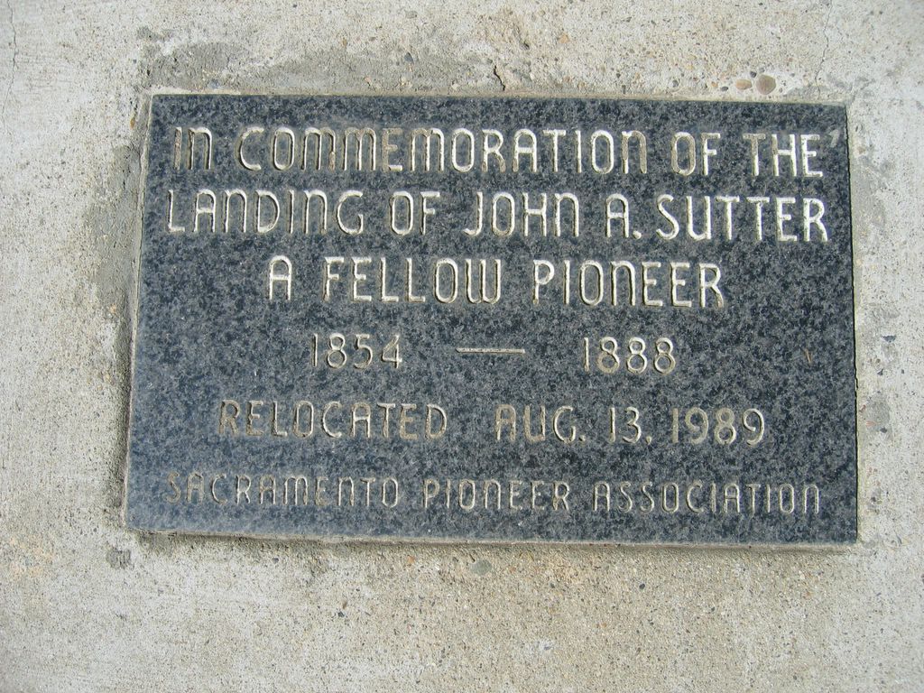
California State Historical Landmark #591
See this location on Yahoo Maps in Flickr
See this location on Google Maps
This landmark is located at the northeast corner of 28th and C Streets, in Stanford Park, Sacramento, California. There are 57 other California State Historical Landmarks in Sacramento County. The GPS coordinates for this location are N 38° 34.905 W 121° 27.965.
You can log your visit to this landmark at waymark.com.
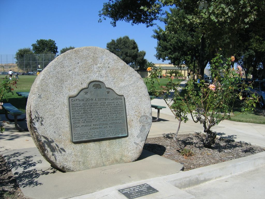
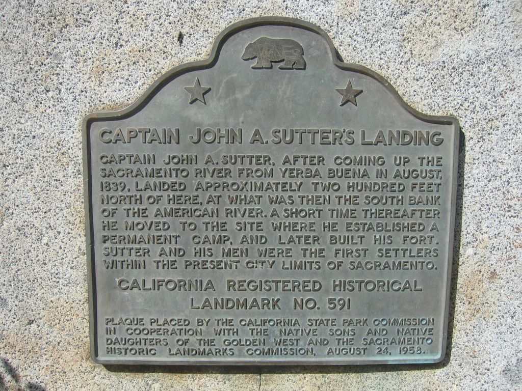
Captain John A. Sutter, after coming up the Sacramento River from Yebra Buena in August, 1839, landed approximately two hundred feet north of here, at what was then the South Bank of the American River. A short time thereafter he moved to the site where he established a permanent camp, and later built a fort. Sutter and his men were the first settlers within the present city limits of Sacramento.
No comments:
Post a Comment