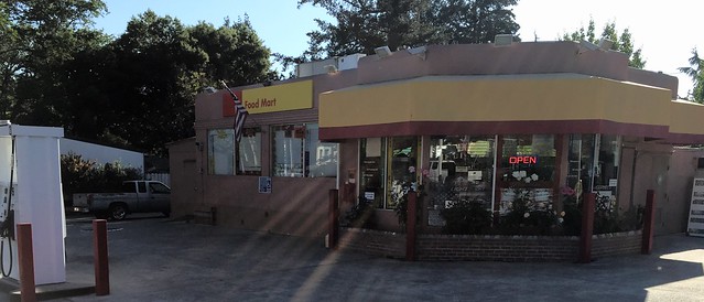
California State Historical Landmark #683
See this location on Yahoo Maps in Flickr
See this location on Google Maps
This landmark is located northeast corner of Highway 29 (Foothill Boulevard) and Lincoln Avenue, Calistoga, California. There are 16 other California State Historical Landmarks in Napa County. The GPS coordinates for this location are N 38° 34' 31.3" W 122° 34' 49.3".
This site is not marked by a plaque. It is mentioned on the plaque for California Historical Landmark #682.
David Hudson was one of the early pioneers who helped develop the upper portion of Napa Valley by purchasing land, clearing it, and planting crops and building homes. Hudson built his cabin in October 1845.
During the winter of 1845-46, John York built a log cabin for himself within the present city limits of Calistoga. The site is at Foothill Boulevard and Lincoln. York planted the first wheat crop in this section of Napa County. Diagonally across the intersection, where a service station now stands, was David Hudson’s cabin, built about the same time as the York’s. The York cabin site is marked by the familiar bronze state landmark plaque, but nothing marks the Hudson cabin site.
Both men moved in later years to larger quarters as their families grew. Hudson fashioned a split-redwood house on the north side of Hudson Creek, where he lived with his wife and boy. On the south side of the creek but higher up in the hills, York took his wife and three boys, putting up a little split-redwood cabin 10 by 15 feet.

No comments:
Post a Comment