California State Historical Landmark #464
See this location on Yahoo Maps in Flickr
See this location on Google Maps
This landmark is located on the northeast corner of Prairie City Road, 500 feet north of State Highway 50. There are 57 other California State Historical Landmarks in Sacramento County. The GPS coordinates for this location are N 38° 38.665 W 121° 09.457.
You can log your visit to this landmark at waymark.com.

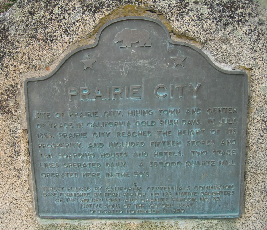
Site of Prairie City, mining town and center of trade in California gold rush days. In July, 1853, Prairie City reached the height of its prosperity, and included fifteen stores and ten boarding houses and hotels. Two stage lines operated daily. A $50,000 quartz mill operated here in the 50's.

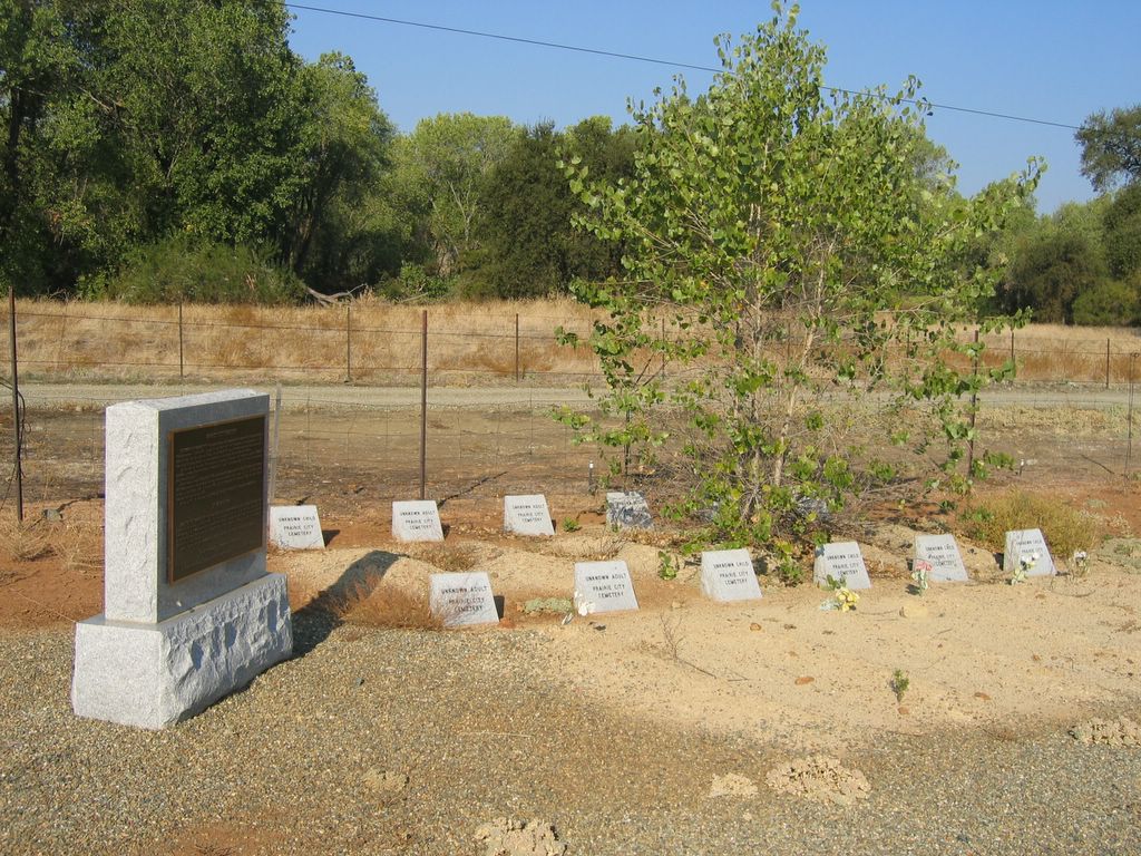
The site of the Prairie City Cemetery that once served the bustling gold rush town of Prairie City was located during construction of the Prairie City Road and Highway 50 interchange in May 1997. It was used between 1853 and at least 1872 and may have first been known as the Alder Creek Hill Cemetery as early as 1852. It was likely used by the citizens of Prairie City and other surrounding communities.
Please visit the Mormon Island Relocation Cemetery on Shadwfax Lane off Green Valley Road in El Dorado Hills, where in 1998, the remains of twelve of the deceased from this cemetery were relocated by the California Department of Transportation.
See this location on Google Maps

The birth of Prairie City, Sacramento County, was announced in the pages of the Sacramento Daily Union newspaper in June of 1853. Located 21 miles from the City of Sacramento, it was approximately 2 miles south of Negro Bar, now known as Folsom. By that month, 40 frame and canvas houses had been erected and a water ditch for mining purposes was being constructed by the Natoma Water and Mining Company.
By July 4th, the town had 1500 inhabitants, including 15 families with women and children. Shortly thereafter, a mining district was formed to establish the "rules" for the miners, and later the area was designated as an election precinct.
Placer deposits began to diminish in 1854 and many of the miners and their families began to move away. Still, others stayed as the had established their homes and families in that vicinity. The U.S. Post Office closed its doors in early March 1866. By the mid-1870s, little of the original town remaind, though the school district continued until about the mid-1880s.
As late as 1901, the abandoned townsite was still referred to as Prairie City, though few resided there.
Here lie the remains of twelve souls discovered during the construction of the Prairie City Road and Highway 50 interchange in May of 1997. They were relocated to this spot by the California Department of Transportation with the cooperation of the County of El Dorado. Through their efforts, and with the assistance of the Folsom Historical Society and the El Dorado County Pioneer Cemeteries Commission, these twelve deceased may now rest in peace forever.
Exactly who and how many deceased were buried at the Prairie City Cemetery may never be known
No comments:
Post a Comment