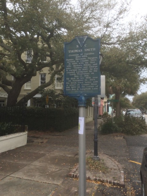
South Carolina Historical Marker #10-03
See this location on Yahoo Maps in Flickr
See this location on Google Maps
This marker is located at the corner of East Bay Street and Longitude Lane, Charleston, South Carolina. The GPS coordinates for this location are N 32° 46.472 W 079° 55.641.
You can log your visit to this landmark at waymark.com.
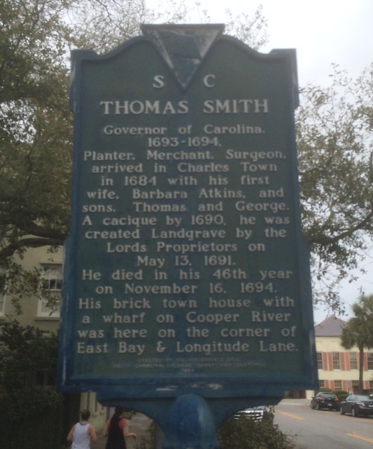
Governor of Carolina, /1693-1694/Planter, Merchant, Surgeon,/arrived in Charles Town in 1684 with his first wife, Barbara Atkins, and sons, Thomas and George. A cacique by 1690, he was created Landgrave by the Lords Proprietors on May 13, 1691. He died in his 46th year on November 16, 1694. His brick town house with a wharf on Cooper River was here on the corner of East Bay & Longitude Lane.
No comments:
Post a Comment