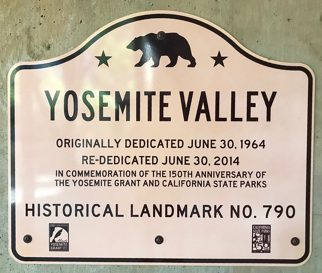
California State Historical Landmark #790
See this location on Yahoo Maps in Flickr
See this location on Google Maps
This landmark is mounted on entrance wall of auditorium building at the Visitor Center in Yosemite National Park. There are 7 other California State Historical Landmarks in Mariposa County. The GPS coordinates for this location are 37° 44' 55.7" N 119° 35' 14.2" W.
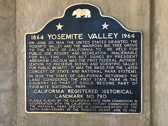
On June 30, 1864, in an act signed by President Abraham Lincoln, the United States granted the Yosemite Valley and the Mariposa Big Tree Grove to the State of California to 'be held for public use, resort, and recreation . . . inalienable for all time.' This, the first federal authorization to preserve scenic and scientific values for public benefit, was the basis for the later concept of state and national park systems. In 1906 the State of California returned the land, considered the first state park in the country, so that it could become part of Yosemite National Park.
No comments:
Post a Comment