Site of China Slough
California State Historical Landmark #594
See this location on Yahoo Maps in Flickr
See this location on Google MapsThe site of the slough, which formerly extended from 3rd to 5th Streets and north of I Street in Sacramento, is now occupied by the Southern Pacific depot.
There are 57 other California State Historical Landmarks in Sacramento County. The GPS coordinates for this location are N 38° 35.020 W 121° 30.020.
You can
log your visit to this landmark at waymark.com.
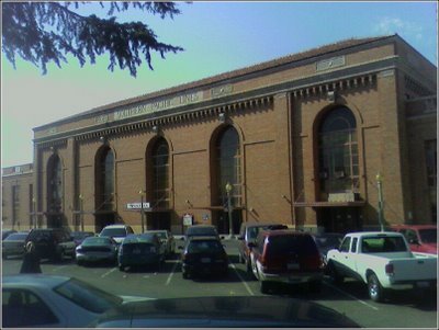
In the early 1800's, the slough was an arm of the river. As late as 1849, schooners coming from San Francisco would moor in what is now known as China Slough.
The history of the current depot site began when the railroad was deeded a wetland known as China Slough for its shops, and built its first shop buildings—wood frame ones—in the vicinity of Sixth and H streets in Sacramento around the fall of 1863. The railroad prepared for the present complex of buildings by driving pilings in four feet of water until the tops were at the water line, then filled around the pilings with granite riprap from Rocklin, California, then sand and silt from the nearby Sacramento and American rivers. The railroad then laid four feet of solid granite on top of the piles and riprap, and began construction of brick and timber buildings. The last of these reached completion and was occupied in 1869. By 1869, a total of 20 acres had been reclaimed from the slough and filled to four feet above the water line, a job that kept more than 100 teams of animals at work.
The following picture from 1878 was taken from 5th Street and I Street. The view includes China Slough, the bridge across the slough and the original train depot.

Residential homes and railroad shops were constructed along the shores of Sutter Slough (also known as Sutter Lake, China Lake or China Slough), which bordered the Alkali Flat neighborhood. At its peak, Central Pacific employed more than 10,000 Chinese workers; many settled along I Street and the shoreline of Sutter Slough (later known as China Slough).
Historical accounts claim that a widespread stench seemed to hover over large sections of Sacramento, the most oppressive stench seemed to come from the stagnant Sutter slough. The lake became a receptacle for filth and garbage of every description and even the dumping ground for railroad scrap including worn-out locomotives and cars. [See
An Economic History of Alkali Flat]
In 1876, the city passed Ordinance No. 93, marking the first action by the City of Sacramento to regulate solid waste disposal. This ordinance prohibited the dumping of garbage in Sutter Slough and China Slough.
In the early 1900's, the railroad started work on the current depot. In order to minimize disruption to current traffic, and to allow for a completely new track arrangement to be constructed, a site for the new depot was chosen just to the southeast of the old Arcade Station. Soon, SP had begun work on filling in what was left of the old China Slough, where the new depot was to be sited. Tons of sand and rubble were dumped along the slough’s southern shore (near Fifth and "I" streets), and company engineers were brought in to begin the task of settling on new trackage alignments and general facilities arrangement.
By 1910, the railroad had filled China Slough.
The following map from the late 1800's shows the slough.

Here is a current map showing the location of the site.
View Larger Map