Nevada Historical Marker #122
See this location on Yahoo Maps in Flickr
See this location on Google Maps
This marker is located at 879 Foothill Roard, Gardnerville, Douglas County, Nevada. There are 17 other historical markers in Douglas County. The GPS coordinates for this location are 38° 54' 04.6" N 119° 49' 33.2" W.
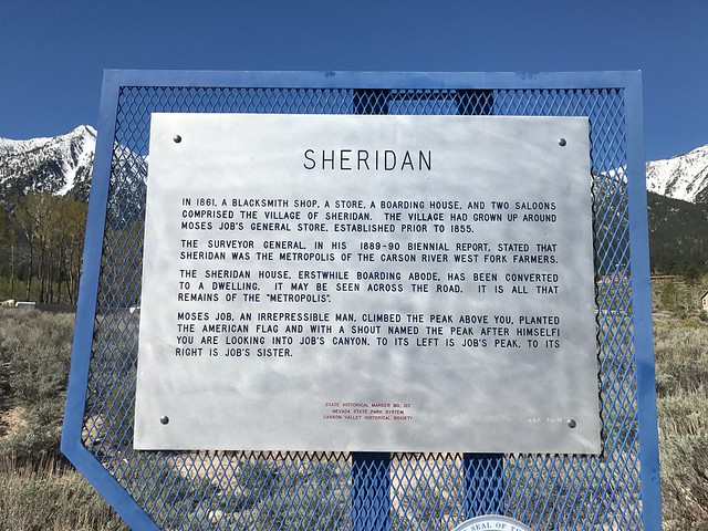
In 1861, a blacksmith shop, a store, a boarding house, and two saloons comprised the village of Sheridan. The village had grown up around Moses Job's General Store prior to 1855.
The surveyor general, in his 1889-90 biennial report, stated that Sheridan was the metropolis of the Carson River West Fork farmers.
The Sheridan House, erstwhile boarding adobe, has been converted to a dwelling. It may be seen across the road. It is all that remains of the "metropolis."
Moses Job, an irrepressible man, climbed the peak above you, planted the American flag and with a shout named the peak after himself! You are looking into Job's Canyon, to its left is Job's Peak, to its right is Job's Sister.
No comments:
Post a Comment