See this location on Yahoo Maps in Flickr
See this location on Google Maps
The GPS coordinates for this location are 55° 01' 30.5" N 2° 08' 10.0" W.

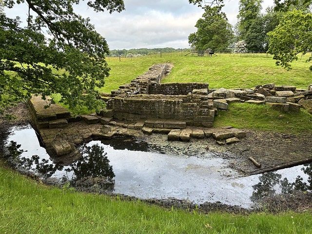
Hadrian's Wall was a 1 17.5km (73 mile)-long Roman barrier built under the Emperor Hadrian in around AD 122. A narrow footbridge originally carried the Wall across the river North Tyne, but this was later replaced with an impressive road bridge. The remains of the stone abutment that joined the bridge to the riverbank survive, along with the foundations of a tower and a section of the Wall.
No comments:
Post a Comment