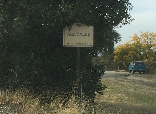
California State Historical Landmark #288
See this location on Yahoo Maps in Flickr
See this location on Google Maps
This landmark is located at the intersection of State Highways 49 and 4, Altaville, California in Calaveras County. There are 40 other California State Historical Landmarks in Calaveras County. The GPS coordinates for this location are N 38° 04.775 W 120° 33.308.
You can log your visit to this landmark at waymark.com.
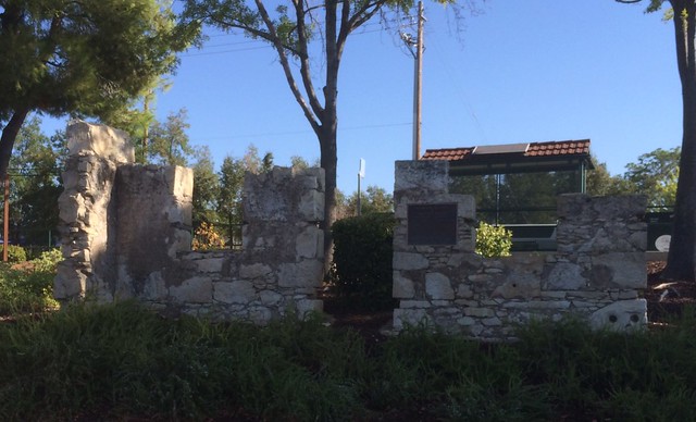
The history of Altaville is closely identified with that of Angels Camp. Altaville has been the foundry town of Calaveras County since D. D. Demerest established a foundry there in 1854. Most of the stamp mills and a large part of the mining machinery erected in Calaveras and Tuolumne Counties were built at the Altaville Foundry. A brick schoolhouse was built at Altaville in 1858 and the townsite was established in 1873.
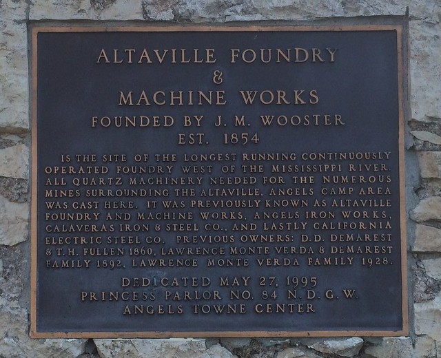
Founded by J.M. Wooster
EST. 1854
Is the site of the longest running continuously operated foundry west of the Mississippi River. All quartz machinery needed for the numerous mines surrounding the Altaville Angels Camp area was cast here. It previously known as Altaville Foundry and Machine Works, Angels Iron Works, Calaveras Iron & Steel Co., and last California Electric Steel Co. Previous owners: D.D. Demarest & T.H. Fullen 1860, Lawrence Monte Verda & Demarest Family 1892, Lawrence Monte Verda Family 1928.
No comments:
Post a Comment