See this location on Yahoo Maps in Flickr
See this location on Google Maps
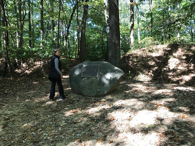
This site is located in Rock Creek Park National Park near the intersection of Military Road NW and Oregon Ave NW, Washington, D.C., 20015. The GPS coordinates for this location are 38° 57.781′ N, 77° 3.037′ W.
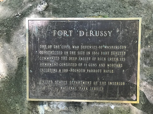
One of the Civil War Defenses of Washington. Constructed on the site in 1861 Fort DeRussy commanded the deep valley of Rock Creek. Its armament consisted of 11 guns and mortars including a 100-pounder Parrott Rifle.
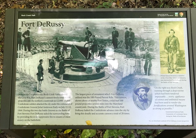
Built in 1861 to protect the Rock Creek Valley during the Civil War, Fort DeRussy's cannon fired a total of 109 projectiles into the northern countryside as 12,000-15,000 Confederate soldiers attacked the city under the command of Confederate General Jubal Anderson Early on July 11-12, 1864. During this two day battle (known as the Battle of Fort Stevens) Fort DeRussy aided the surrounding forts by providing the main suppressive fire to ensure a Union victory on the battlefield.
The largest piece of armament which Fort DeRussy utilized was the 100-Pound Parrott Rifle. This cannon, shown above at nearby Fort Totten, could hurl 100 pound projectiles several miles into the Maryland countryside. During the Battle of Fort Stevens, Fort DeRussy halted the Confederate advance into the city by firing this deadly and accurate cannon a total of 28 times.
[image Parrott Rifle at Fort Totten] Members of the 3rd Massachusetts Heavy Artillery by 100-Pounder Parrott Rifle inside Fort Totten, 1865.
[photo of Private Samuel Strawser] Private Samuel Strawser, a member of the 151st Ohio Volunteer Infantry, was stationed at Fort DeRussy during the Battle of Fort Stevens.
[photo of General Jubal Early] "On the right was Rock Creek, running through a deep ravine which had been rendered impassable... every appliance
You can download a podcast of Fort DeRussy at www.nps.gov/rocr.
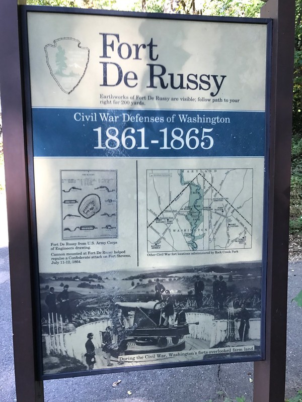
Earthworks of Fort De Russy are visible; follow path to your right for 200 yards.
[drawing of fort] Fort De Russy from U.S. Army Corps of Engineers drawing.
Cannon mounted at Fort De Russy helped repulse a Confederate attack on Fort Stevens, July 11012, 1864.
[map of northern DC] Other Civil War fort locations administered by Rock Creek Park.
[picture of unnamed fort] During the Civil War, Washington's forts overlooked farm land.
No comments:
Post a Comment