California State Historical Landmark #183
See this location on Yahoo Maps in Flickr
See this location on Google Maps
This landmark is located 75 feet east of the intersection of 2nd and D Streets, Tehama, California. There is three other California State Historical Landmarks in Tehama County. The GPS coordinates for this location are 40° 01' 35.0" N 122° 07' 16.9" W.
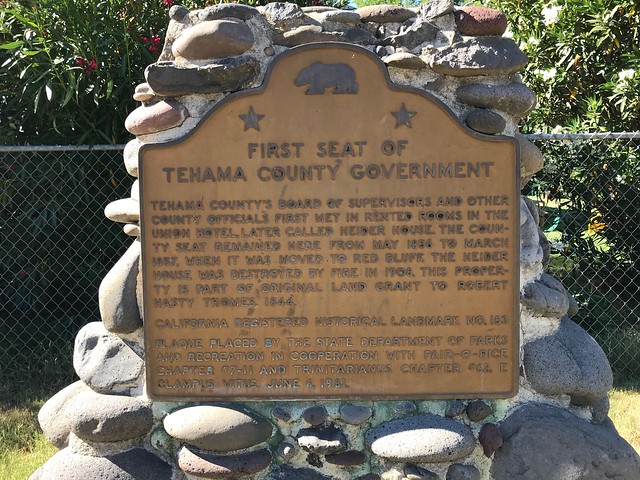
Tehama County's Board of Supervisors and other county officials first met in rented rooms in the Union Hotel, later called Heider House. The county seat remained here from May 1856 to March 1857, when it was moved to Red Bluff. The Heider House was destroyed by fire in 1908. This property is part of original land grant to Robert Hasty Thomes, 1844.
No comments:
Post a Comment