California State Historical Landmark #460
See this location on Yahoo Maps in Flickr
See this location on Google Maps
This landmark is located on State Highway 120, 2.4 miles southeast of Groveland, California in Tuolumne County. There are 19 other California State Historical Landmarks in Tuolumne. The GPS coordinates for this location are N 37° 49.493 W 120° 11.748.
You can log your visit to this landmark at waymark.com.
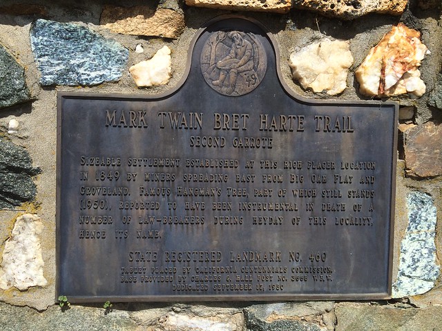
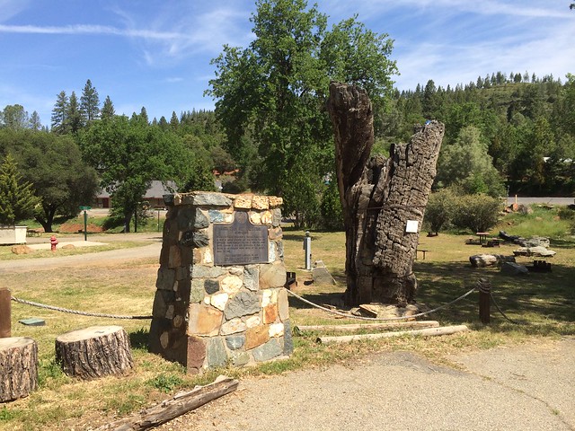
A sizable settlement was established at this rich placer location in 1849 by miners spreading east from Big Oak Flat and Groveland. The famous hangman's tree, part of which still stands (1950), is reported to have been instrumental in the death of a number of lawbreakers during the heyday of this locality.
No comments:
Post a Comment