California State Historical Landmark #432
See this location on Yahoo Maps in Flickr
See this location on Google Maps
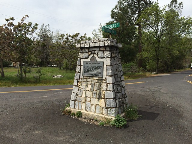
This landmark is located at the intersection of Springfield and Horseshoe Bend Roads, 1.1 miles southwest of Columbia, California in Tuolumne County. There are 19 other California State Historical Landmarks in Tuolumne. The GPS coordinates for this location are N 38° 01.307 W 120° 24.765.
You can log your visit to this landmark at waymark.com.
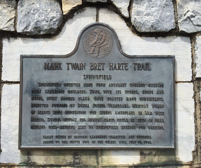
Springfield received name from the abundant springs gushing from limestone boulders. The town with its stores, shops, and hotel built around a plaza once boasted 2,000 inhabitants. Believed founded by Donna Josefa Valmesada, Mexican woman of means with reputation for aiding Americans in the war with Mexico. During heyday, 150 miners' carts could be seen on the road, hauling gold-bearing dirt to Springfield springs for washing.
No comments:
Post a Comment