California State Historical Landmark #122
See this location on Yahoo Maps in Flickr
See this location on Google Maps
This landmark is located on State Highway 49, 2.5 miles north of Chinese Camp, California in Tuolumne County. There are 19 other California State Historical Landmarks in Tuolumne. The GPS coordinates for this location are N 37° 54.304 W 120° 27.213.
You can log your visit to this landmark at waymark.com.
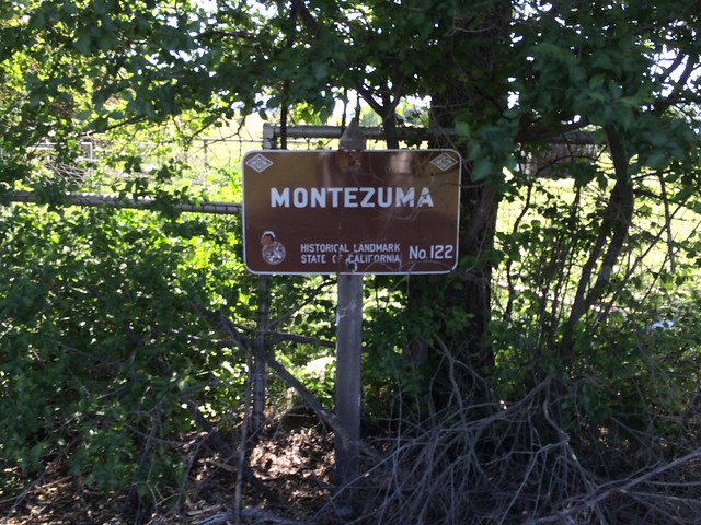
First record of Montezuma was June 1850 when partners Solomon Miller and Peter K. Aurand, proprietors of the 'Montezuma Tent,' were attacked and Aurand killed by a group of Mexicans during the foreign miners tax excitement of that period. Due to the lack of water, little mining occurred here until 1852 when a ditch and flume were completed bringing water for placer mining. Two types of mining were carried on, placer operations on the flats and tunnels extending under Table Mountain. The gravel produced 3-1/2 C. per pan in the mid 50s. The yield was from $5 to $10 per day. One placer nugget found in 1853 weighed 18 lbs. 8 oz. By late 1852 the population was about 800. At its zenith Montezuma City had four saloons, two hotels, Adams Express Co., post office, church, some homes, and many tents and cabins. The town was nearly destroyed by an incendiary fire which started in Clarks Hotel on June 29, 1866.
No comments:
Post a Comment